
Informations
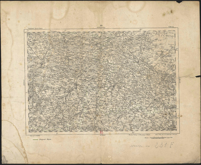
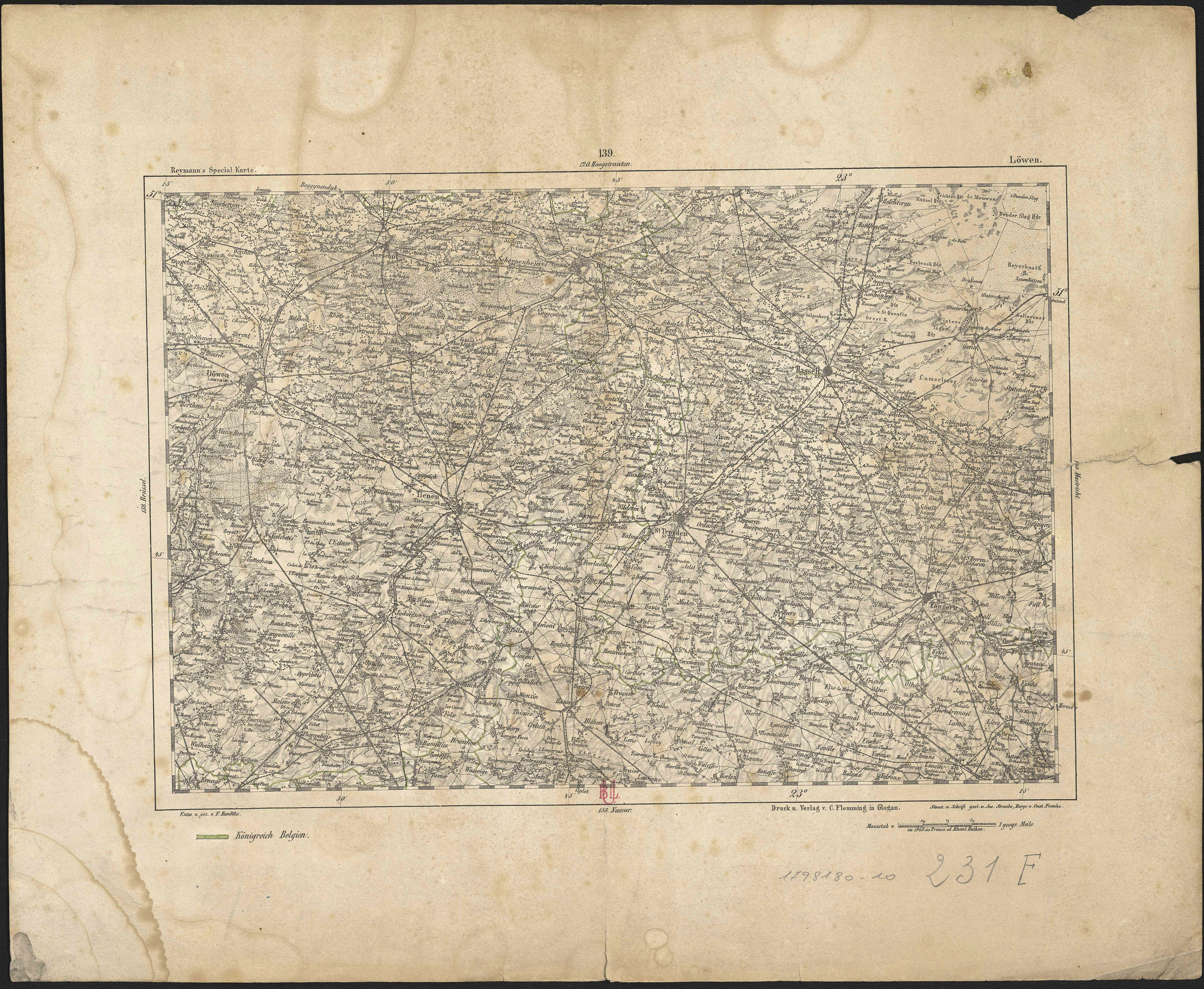
Reymann's Special Karte. 139, Löwen.
Author(s), creator(s), collaborator(s) : Reymann, Gottlob Daniel; Handtke, Friedrich H.
Type of the represented object : Map
Permalink
https://hdl.handle.net/2268.1/3797
Détails
| Author(s), creator(s), collaborator(s): | Reymann, Gottlob Daniel (1759-1837) (author) Handtke, Friedrich H. (1815-1879) (cartographer) |
| Editor: | Glogau : C. Flemming |
| Place of creation of the original object: | Glogow (Pologne) |
| First publication of the original object: | 1853 19th century Contemporary time (1789-20..) |
| Original object location: | Réseau des Bibliothèques |
| Collection: | Maps |
| Identifiant(s): | 231F (cote ULiège) 1798180-10 (code-barres ULiège) |
| Original object language: | German |
| Abstract: | Echelle [1:195 000] (W 22°15' -- E 23°13'/N 51° -- S 50°37') |
| Material, support of the original object: | Papier |
| Dimensions, weight or duration: | 25 x 36 cm |
| Physical description of the represented object : | 1 carte |
| Geographical Location represent or evoke: | Louvain (Belgique) |
| CREF classification(s): | Sciences de la terre et du cosmos |
| Classification(s): | Physical, chemical, mathematical & earth Sciences => Earth sciences & physical geography |
| Part of: | Public domain |
| Permalink: | https://hdl.handle.net/2268.1/3797 |
Items in DONum are protected by copyright, with all rights reserved, unless otherwise indicated.