
Informations
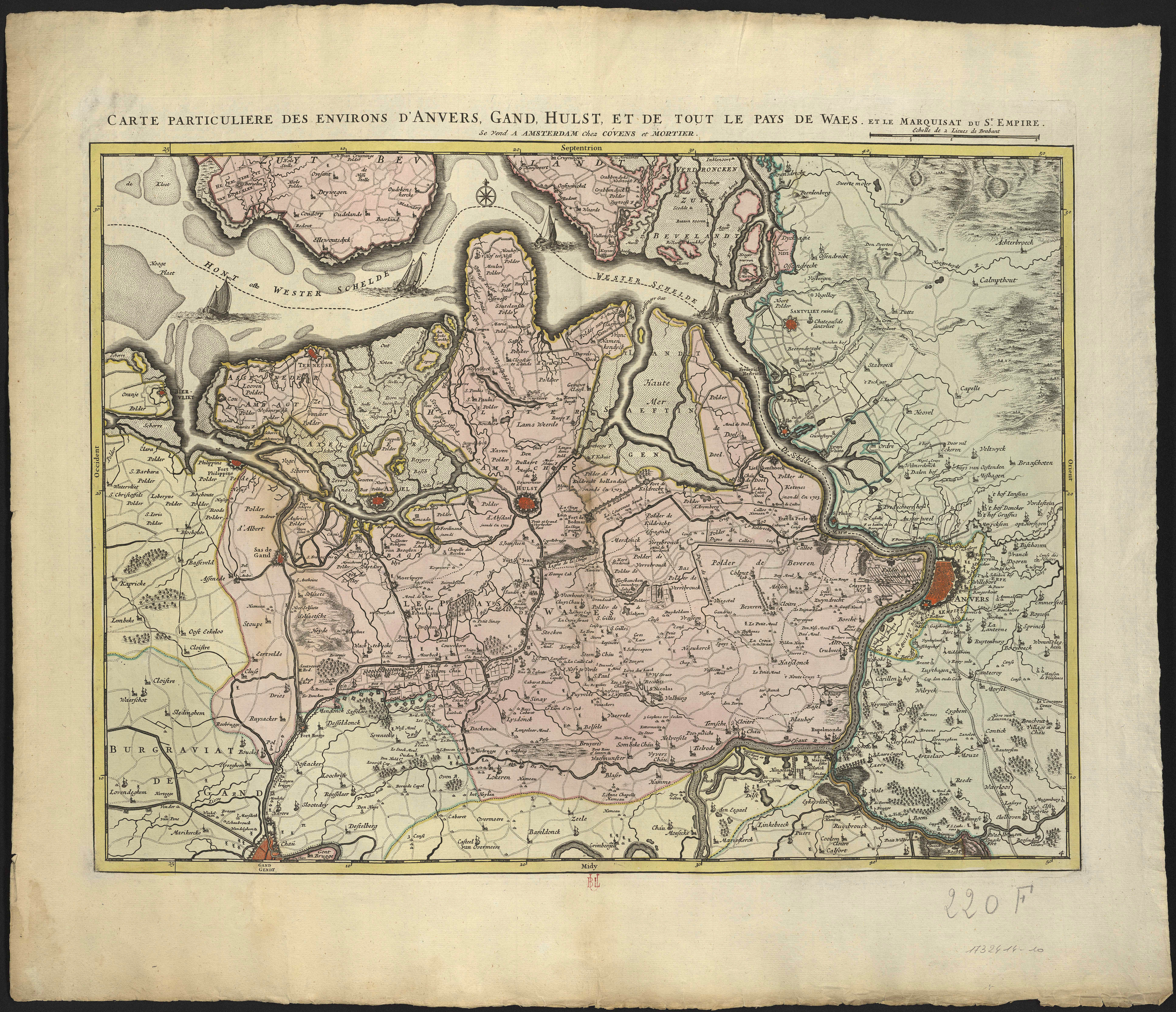
Carte particulière des environs d'Anvers, Gand, Hulst, et de tout le pays de Waes, et le marquisat du St. Empire.
Author(s), creator(s), collaborator(s) :
Type of the represented object : Map
Permalink
https://hdl.handle.net/2268.1/3770
Détails
| Editor: | A Amsterdam : Chez Covens et Mortier |
| Place of creation of the original object: | Amsterdam (Pays-Bas) |
| First publication of the original object: | 1745 18th century Modern times (1492-1789) |
| Original object location: | Réseau des Bibliothèques |
| Collection: | Maps |
| Identifiant(s): | 220F (cote ULiège) 1732414-10 (code-barres ULiège) |
| Original object language: | French |
| Abstract: | Echelle [1:120 000] |
| Material, support of the original object: | Papier |
| Dimensions, weight or duration: | 41 x 56 cm |
| Physical description of the represented object : | 1 carte : couleurs |
| Geographical Location represent or evoke: | Anvers (Belgique) Gand (Belgique) |
| CREF classification(s): | Sciences de la terre et du cosmos |
| Classification(s): | Physical, chemical, mathematical & earth Sciences => Earth sciences & physical geography |
| Part of: | Public domain |
| Permalink: | https://hdl.handle.net/2268.1/3770 |
Items in DONum are protected by copyright, with all rights reserved, unless otherwise indicated.