
Informations
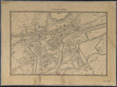
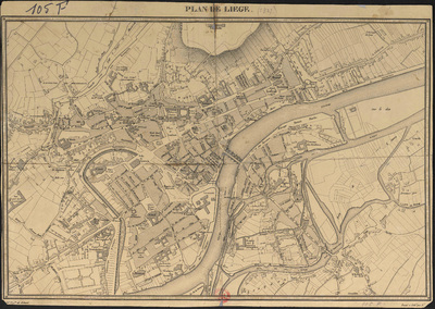
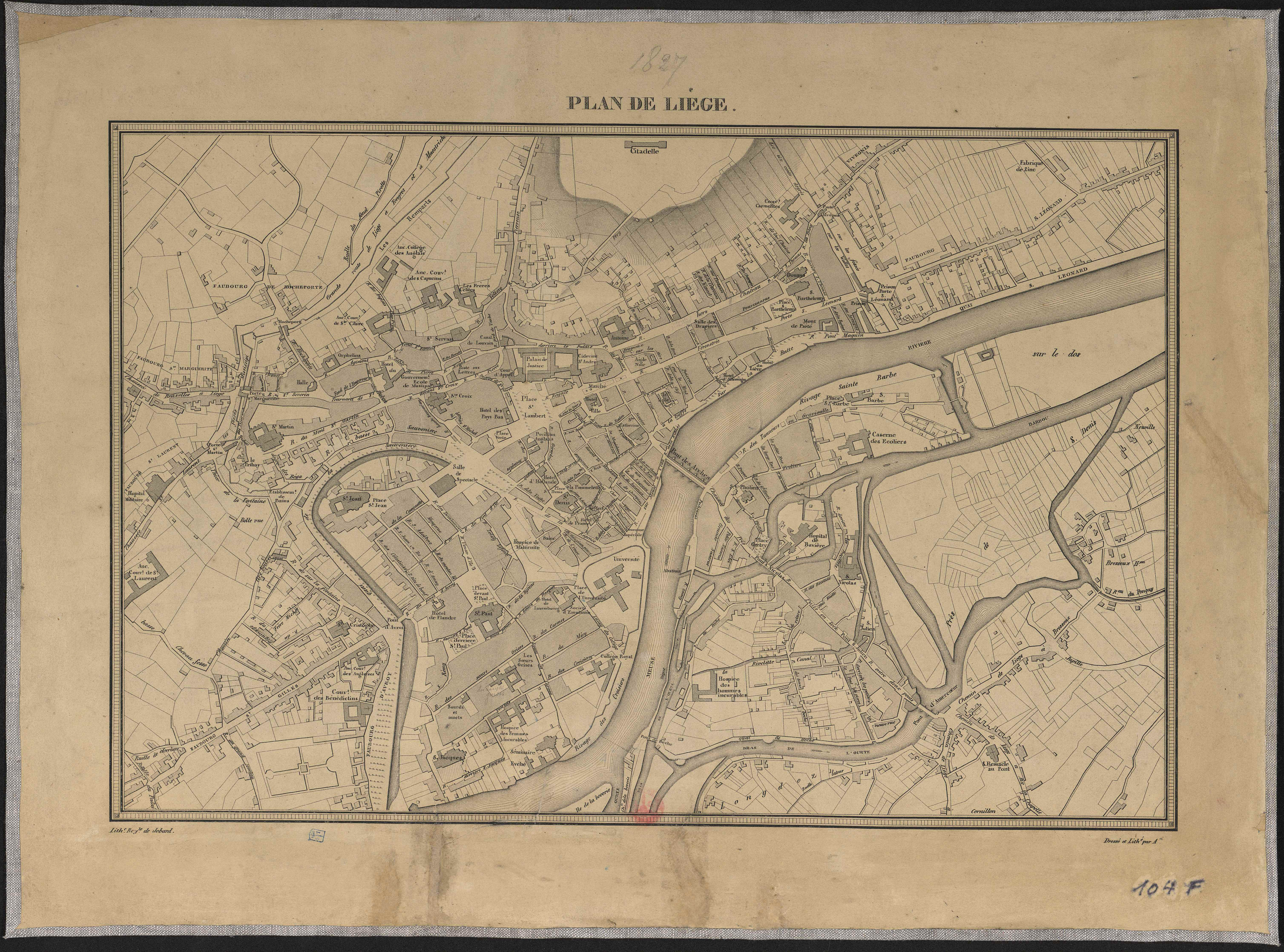
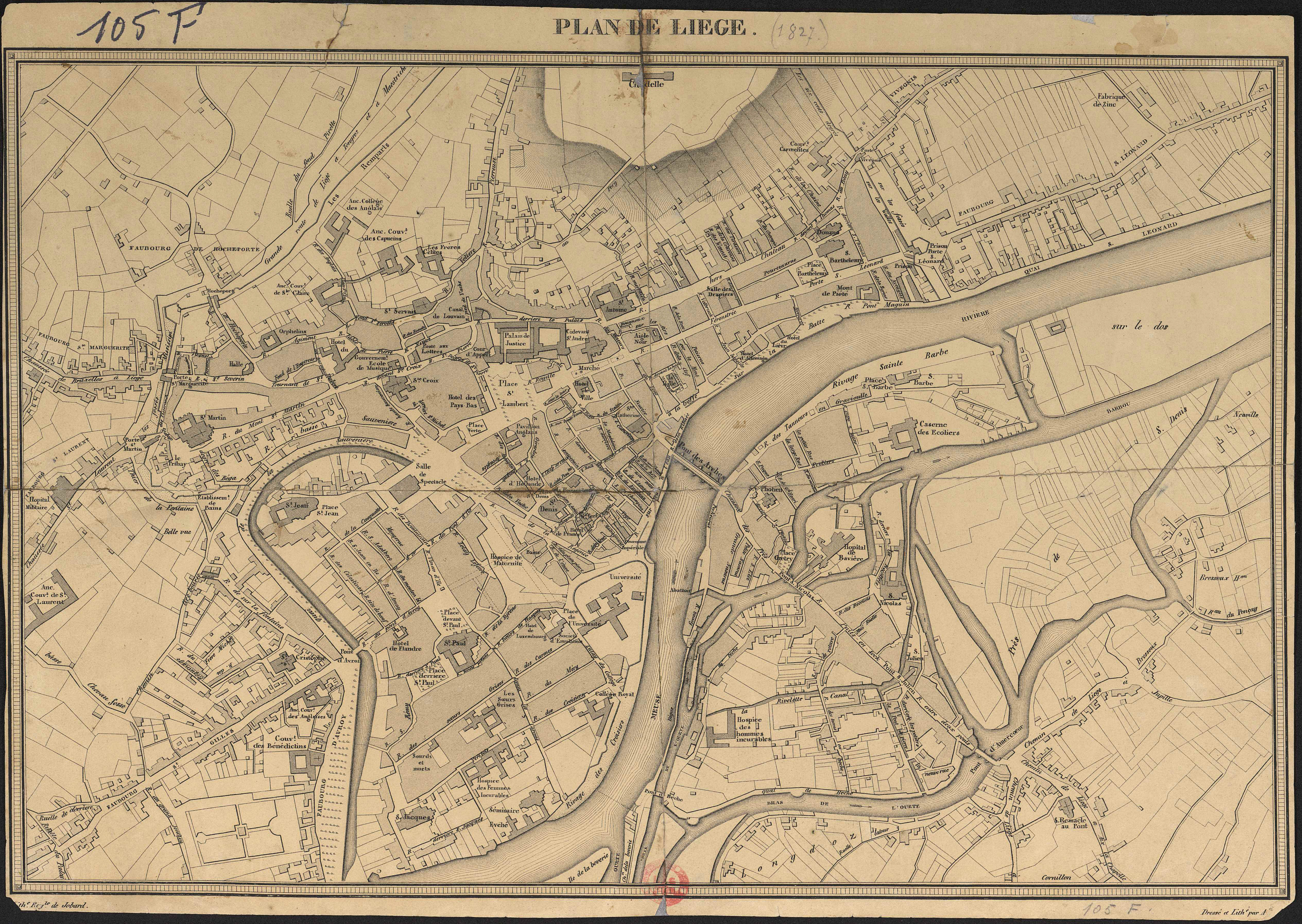
Plan de Liège.
Author(s), creator(s), collaborator(s) : Armand, L.
Type of the represented object : Plan (map)
Permalink
https://hdl.handle.net/2268.1/3680
Détails
| Author(s), creator(s), collaborator(s): | Armand, L. (author) |
| Editor: | [Bruxelles] : Lith. Royale de Jobard |
| Place of creation of the original object: | Bruxelles (Belgique) |
| First publication of the original object: | 1827 19th century Contemporary time (1789-20..) |
| Original object location: | Réseau des Bibliothèques |
| Collection: | Maps |
| Identifiant(s): | 104F (cote ULiège) ; 709504103 (code-barres ULiège) 105F (cote ULiège) ; 709504102 (code-barres ULiège) |
| Original object language: | French |
| Abstract: | Echelle non mentionnée. |
| Material, support of the original object: | Papier |
| Dimensions, weight or duration: | 30 x 43 cm |
| Physical description of the represented object : | 1 carte. |
| Geographical Location represent or evoke: | Liège (Belgique) |
| CREF classification(s): | Sciences de la terre et du cosmos Bâtiments, génie civil, transports |
| Classification(s): | Engineering, computing & technology => Architecture Physical, chemical, mathematical & earth Sciences => Earth sciences & physical geography |
| Part of: | Public domain |
| Permalink: | https://hdl.handle.net/2268.1/3680 |
Items in DONum are protected by copyright, with all rights reserved, unless otherwise indicated.