
Informations
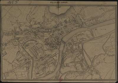
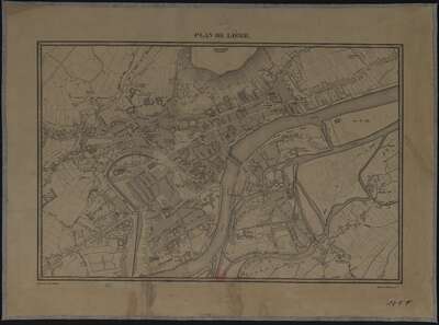
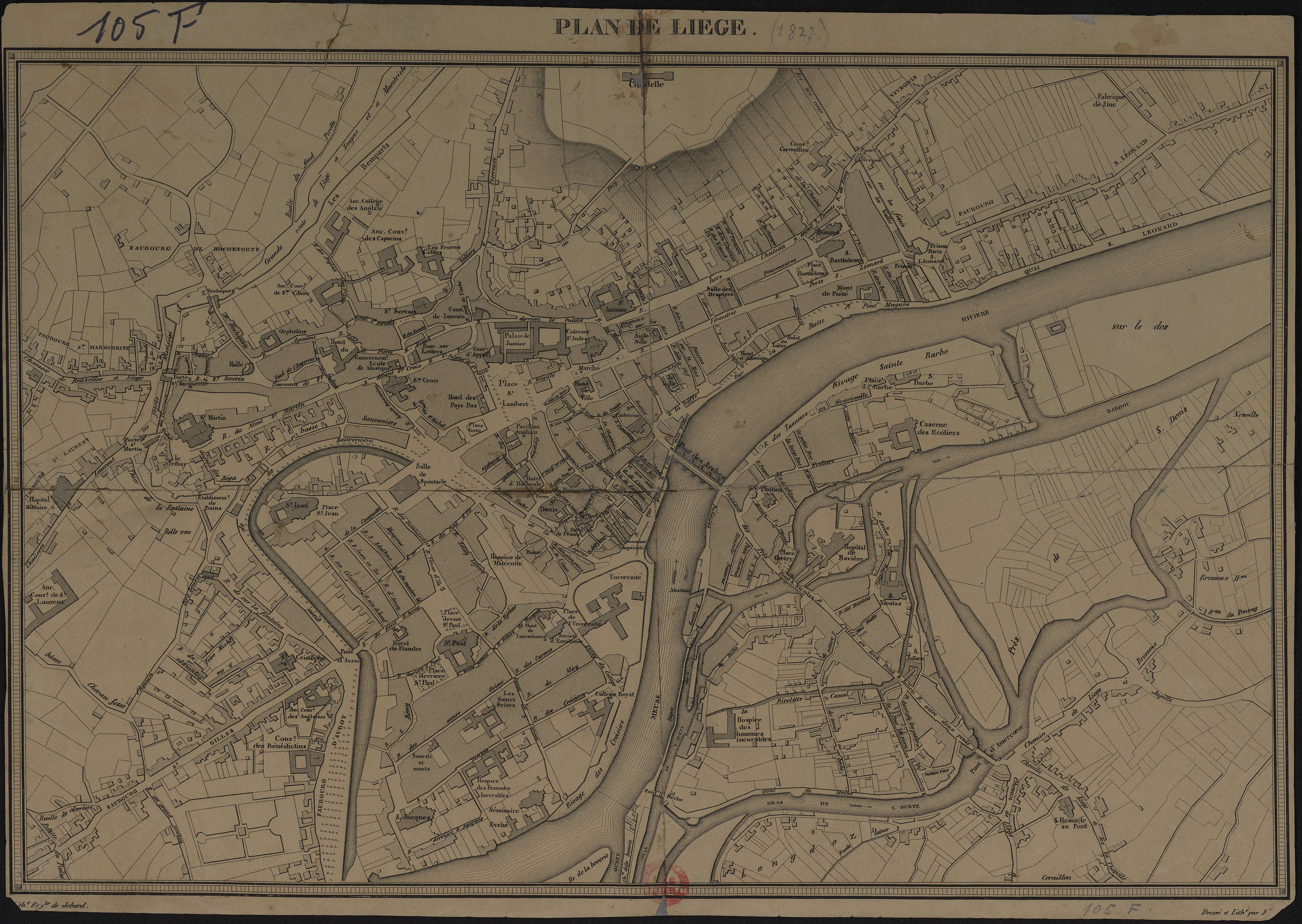
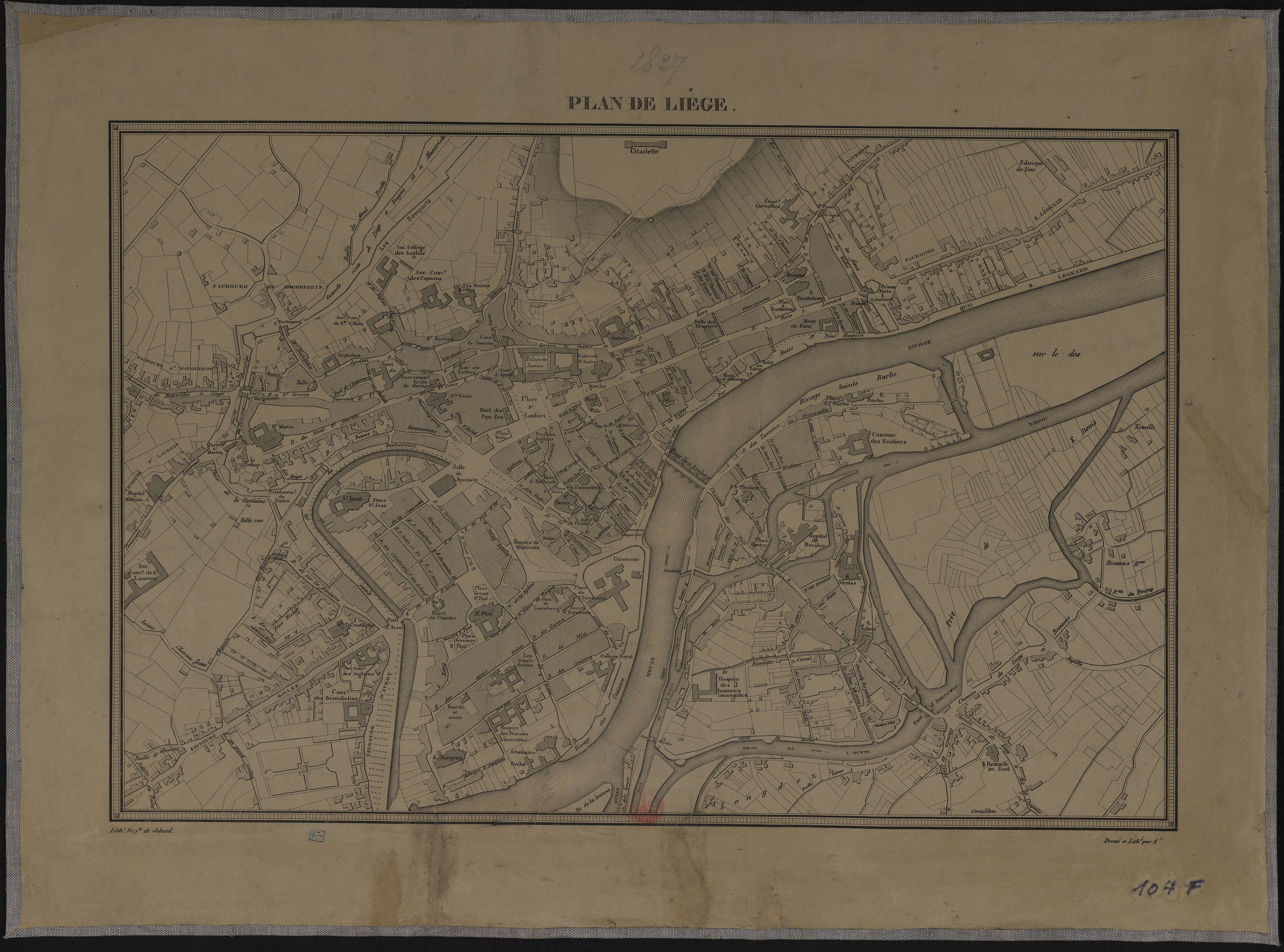
Plan de Liège.
Authors, creators, collaborators : Armand, L.
Type of the represented object : Plan (map)
Permalink
https://hdl.handle.net/2268.1/3680
Détails
| Authors, creators, collaborators: | Armand, L. (authors) |
| Producers, publishers: | [Bruxelles] : Lith. Royale de Jobard |
| Place of creation of the original object: | Bruxelles (Belgique) |
| First publication of the original object: | [1827?] 19th century Contemporary time (1789-20..) |
| Original object location: | Réseau des Bibliothèques |
| Collection: | Maps |
| Réseau des Bibliothèques: | Identifier: 990017187880502321 Barcode/Inventory no.: 709504103; 709504102 Call number: R176A2F; R177A2F |
| Original object language: | French |
| Abstract: | Echelle non mentionnée. |
| Material, support of the original object: | Papier |
| Physical description of the represented object: | 1 carte : entoilée ; 30 x 43 cm |
| Description: | dressé et lithographié par Ad. |
| Geographical Location represent or evoke: | Liège (Belgique) |
| Keyword: | Liège (Belgique) -- 19e siècle; Liège (Belgium); Cartes anciennes.; Early maps. |
| Part of: | Public domain |
| Permalink: | https://hdl.handle.net/2268.1/3680 |
Items in DONum are protected by copyright, with all rights reserved, unless otherwise indicated.
