
Informations
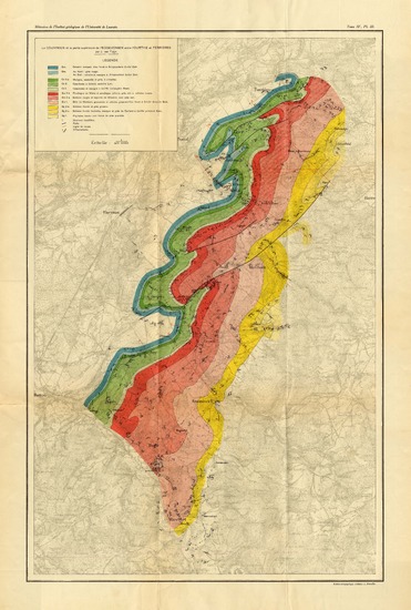
Le Couvinien et la partie supérieure de l'Eodévonien entre l'Ourthe et Ferrières
Author(s), creator(s), collaborator(s) : Van Tuijn, J.
Type of the represented object : Map
Permalink
https://hdl.handle.net/2268.1/1156
Détails
| Author(s), creator(s), collaborator(s): | Van Tuijn, J. (author) |
| Editor: | Université Catholique de Louvain |
| Place of creation of the original object: | Louvain |
| Creation of the original object: | 1927 20th century Contemporary time (1789-20..) |
| Original object location: | Réseau des Bibliothèques |
| Original object language: | French |
| Material, support of the original object: | papier |
| Dimensions, weight or duration: | 65 x 42 cm |
| Physical description of the represented object : | 1 carte : coul. |
| Description: | Echelle 1:40.000. - Mémoires de l'Institut géologique de l'Université de Louvain ; 4 |
| Geographical Location represent or evoke: | Belgique |
| CREF classification(s): | Sciences de la terre et du cosmos |
| Classification(s): | Physical, chemical, mathematical & earth Sciences => Earth sciences & physical geography |
| Part of: | Protected domain |
| Permalink: | https://hdl.handle.net/2268.1/1156 |

Items in DONum are protected by copyright, with all rights reserved, unless otherwise indicated.