

Informations
Carte géologique de la Province de Liége
Author(s), creator(s), collaborator(s) : Dumont, André Hubert
Type of the represented object : Map
Permalink
https://hdl.handle.net/2268.1/1149
Détails
| Author(s), creator(s), collaborator(s): | Dumont, André Hubert (1809-1857) (author) |
| Editor: | Etablissement géographique de Bruxelles |
| Place of creation of the original object: | Bruxelles |
| Creation of the original object: | 1832 19th century Contemporary time (1789-20..) |
| Original object location: | Réseau des Bibliothèques |
| Collection: | Maps |
| Original object language: | French |
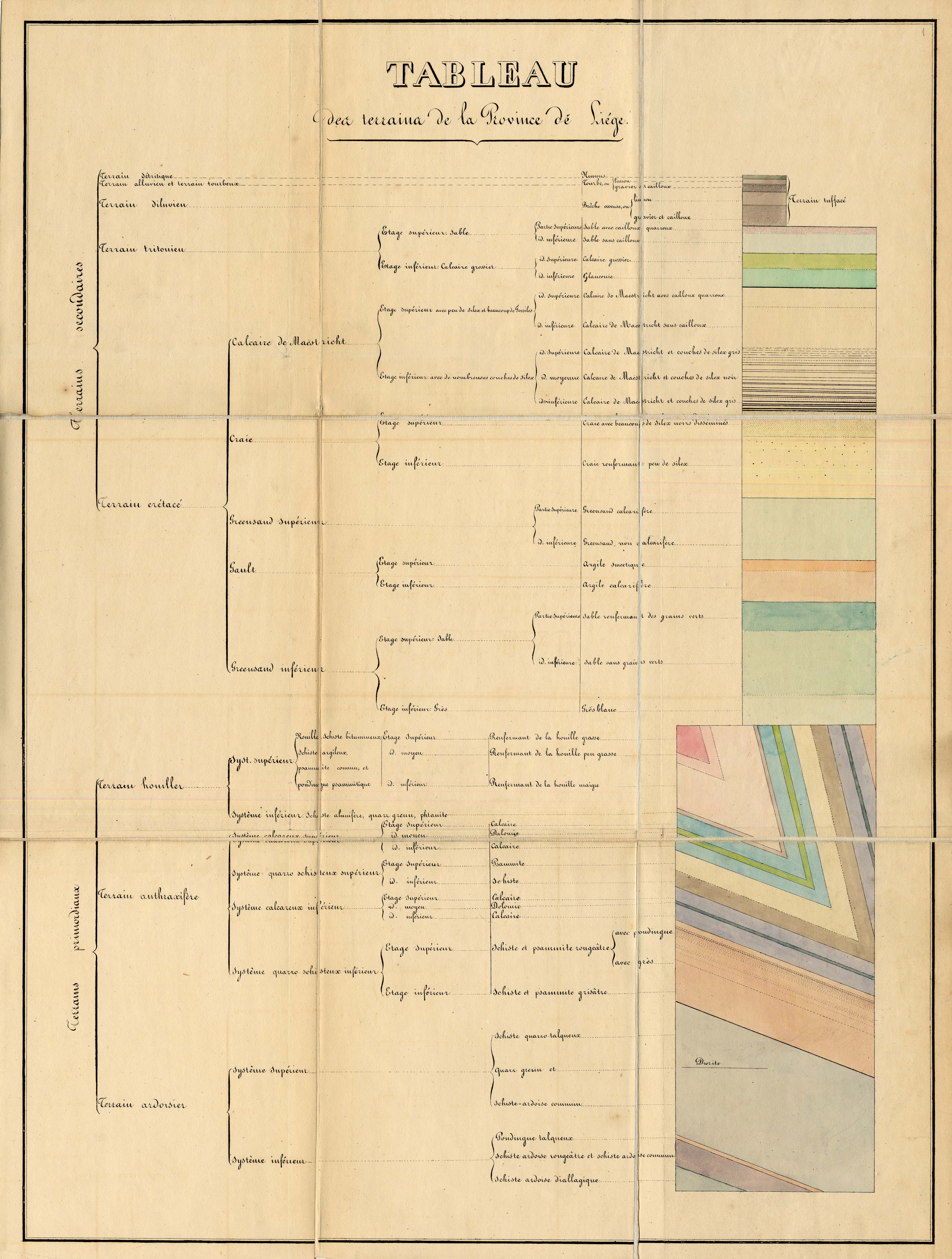
| Abstract: | La carte est accompagnée d'une planche de coupes des terrains primordiaux de la Province de Liége et d'un tableau des terrains de la Province de Liége |
| Material, support of the original object: | papier |
| Dimensions, weight or duration: | 52 x 78 cm |
| Physical description of the represented object : | 1 carte : coul. |
| Description: | Echelle 1/86.400 |
| Geographical Location represent or evoke: | Belgique |
| CREF classification(s): | Sciences de la terre et du cosmos |
| Classification(s): | Physical, chemical, mathematical & earth Sciences => Earth sciences & physical geography |
| Part of: | Public domain |
| Permalink: | https://hdl.handle.net/2268.1/1149 |
Items in DONum are protected by copyright, with all rights reserved, unless otherwise indicated.