

Informations
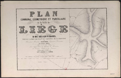
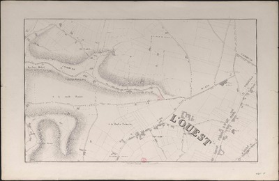
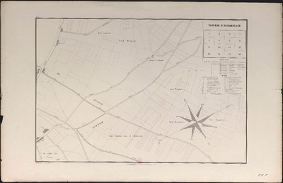
Plan communal, géométrique et parcellaire de la ville de Liège et de ses environs dressé d'après le plan du Cadastre...
Author(s), creator(s), collaborator(s) : Blonden, Hubert-Guillaume
Type of the represented object : Plan (map)
Permalink
https://hdl.handle.net/2268.1/1145
Détails
| Author(s), creator(s), collaborator(s): | Blonden, Hubert-Guillaume (1816-1881) (editor) |
| Editor: | Établissement lithographique de D.que Avanzo |
| Place of creation of the original object: | Liège (Belgique) |
| Creation of the original object: | 1860 19th century Contemporary time (1789-20..) |
| Original object location: | Réseau des Bibliothèques |
| Collection: | Maps |
| Identifiant(s): | 000125F (cote ULiège) 709504166 (code-barres ULiège) |
| Original object language: | French |
| Material, support of the original object: | Papier |
| Dimensions, weight or duration: | 43 x 60 cm. |
| Physical description of the represented object : | 16 planches : n. & b. |
| Description: | Echelle 1:2500 |
| Geographical Location represent or evoke: | Liège (Belgique) |
| Keyword: | Liège (Belgique) -- Plans; Liège (Belgique) -- Cartes; Liege (Belgium) -- Maps |
| CREF classification(s): | Bâtiments, génie civil, transports |
| Classification(s): | Engineering, computing & technology => Architecture |
| Part of: | Public domain |
| Permalink: | https://hdl.handle.net/2268.1/1145 |

Items in DONum are protected by copyright, with all rights reserved, unless otherwise indicated.