

Informations
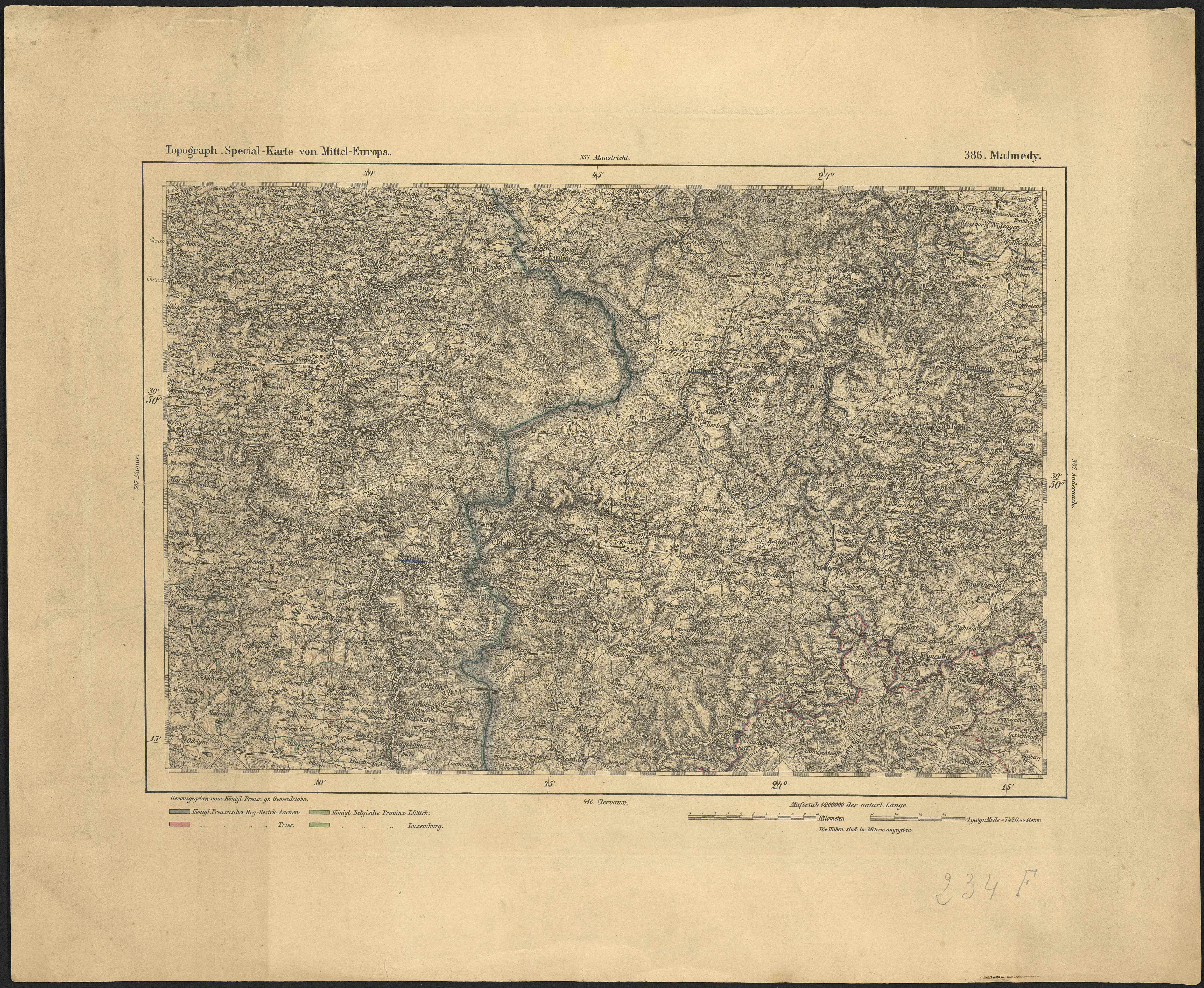
Topograph. Special-Karte von Mittel-Europa. 386, Malmedy.
Authors, creators, collaborators : Königlich Preussischen Grossen Generalstabes
Type of the represented object : Map
Permalink
https://hdl.handle.net/2268.1/3800
Détails
| Authors, creators, collaborators: | Königlich Preussischen Grossen Generalstabes (editors) |
| Producers, publishers: | [S.l.] : [s.n.] |
| First publication of the original object: | 20th century Contemporary time (1789-20..) |
| Original object location: | Réseau des Bibliothèques |
| Identifiers: | 234F (cote ULiège) 709504315 (code-barres ULiège) |
| Réseau des Bibliothèques: | Identifier: 990017981720502321 |
| Original object language: | German |
| Abstract: | Echelle 1:200 000 |
| Material, support of the original object: | Papier |
| Dimensions, weight or duration: | 25 x 36 cm |
| Physical description of the represented object: | 1 carte : couleurs |
| Geographical Location represent or evoke: | Malmédy (Belgique) |
| Part of: | Public domain |
| Permalink: | https://hdl.handle.net/2268.1/3800 |
Items in DONum are protected by copyright, with all rights reserved, unless otherwise indicated.
