
Informations
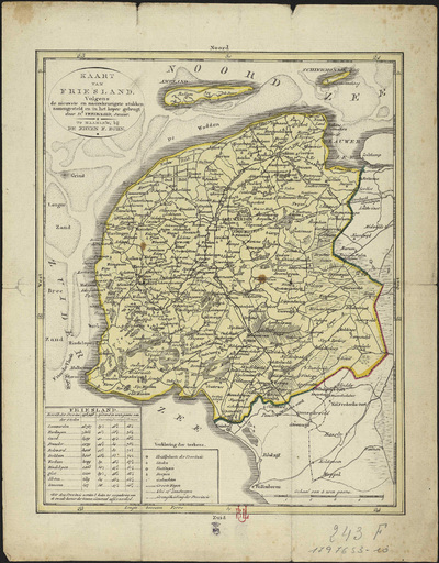
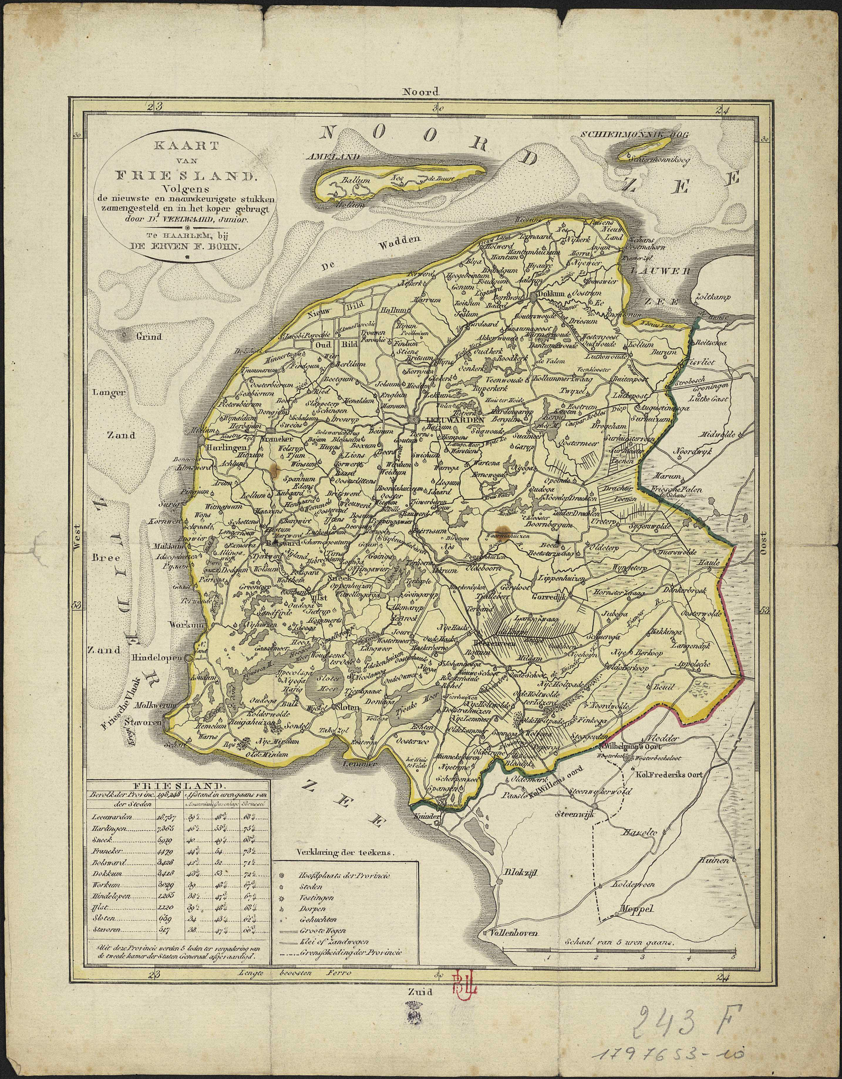
Kaart van Friesland volgens de nieuwste en naauwkeurigste stukken zamengesteld en in het koper gebragt door D. Veelwaard, Junior.
Authors, creators, collaborators : Veelwaard, Daniel
Type of the represented object : Map
Permalink
https://hdl.handle.net/2268.1/3786
Détails
| Authors, creators, collaborators: | Veelwaard, Daniel (1766-1851) (authors) |
| Producers, publishers: | Te Haarlem : De erven F. Bohn |
| Place of creation of the original object: | Haarlem (Pays-Bas) |
| First publication of the original object: | 19th century Contemporary time (1789-20..) |
| Original object location: | Réseau des Bibliothèques |
| Collection: | Maps |
| Réseau des Bibliothèques: | Identifier: 990017976530502321 Barcode/Inventory no.: 1797653-10 Call number: R109A3F |
| Original object language: | Dutch, Flemish |
| Abstract: | Echelle [1:300 000] |
| Material, support of the original object: | Papier |
| Dimensions, weight or duration: | 26 x 21 cm |
| Physical description of the represented object: | 1 carte : couleurs |
| Description: | Légende reprenant les symboles utilisés pour représenter la capitale de la province, les villes, les forteresses, les villages, les hameaux, les routes. |
| Geographical Location represent or evoke: | Frise, Province de (Pays-Bas) |
| Part of: | Public domain |
| Permalink: | https://hdl.handle.net/2268.1/3786 |
Items in DONum are protected by copyright, with all rights reserved, unless otherwise indicated.
