
Informations
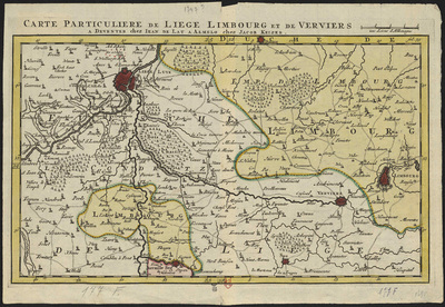
Carte particulière de Liège, Limbourg et de Verviers.
Authors, creators, collaborators : Lat, Jan de; Keizer, Jacob
Type of the represented object : Map
Permalink
https://hdl.handle.net/2268.1/3734
Détails
| Authors, creators, collaborators: | Lat, Jan de (17..?-1750) (engravers) Keizer, Jacob (1706-1750) (engravers) |
| Producers, publishers: | A Deventer : Chez Jean de Lat A Almelo : Chez Jacob Keizer |
| Place of creation of the original object: | Deventer (Pays-Bas) |
| First publication of the original object: | 18th century Modern times (1492-1789) |
| Original object location: | Réseau des Bibliothèques |
| Collection: | Maps |
| Réseau des Bibliothèques: | Identifier: 990017498720502321 Barcode/Inventory no.: 709504096 Call number: R104A3F |
| Original object language: | French |
| Abstract: | Echelle [1:154 000] |
| Material, support of the original object: | Papier |
| Dimensions, weight or duration: | 21 x 36 cm |
| Physical description of the represented object: | 1 carte: couleurs. |
| Geographical Location represent or evoke: | Liège (Principauté) |
| Part of: | Public domain |
| Permalink: | https://hdl.handle.net/2268.1/3734 |

Items in DONum are protected by copyright, with all rights reserved, unless otherwise indicated.
