Informations
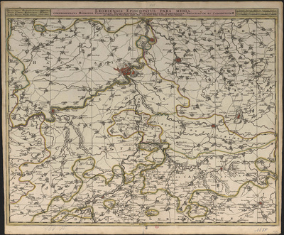
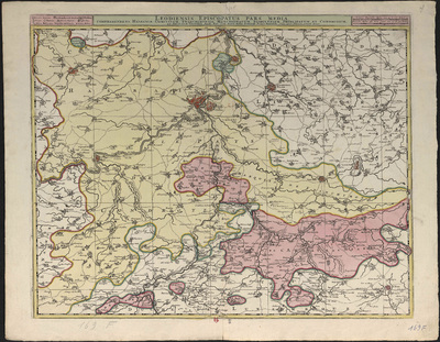
Leodiensis episcopatus pars media : omprehendens hasbaniæ comitatum, franchimontis marchionatum, stabulensem principatum et condrusium, per Nicolaum Visscher Amst: Bat: cum privil. ordin.: general: Belgii Foederati.
Authors, creators, collaborators : Visscher, Claes
Type of the represented object : Map
Permalink
https://hdl.handle.net/2268.1/3717
Détails
| Authors, creators, collaborators: | Visscher, Claes (1618-1679) (authors) |
| Producers, publishers: | [Amsterdam] : Nunc apud Petrum Schenk Junior |
| Place of creation of the original object: | Amsterdam (Pays-Bas) |
| First publication of the original object: | 17th century Modern times (1492-1789) |
| Original object location: | Réseau des Bibliothèques |
| Collection: | Maps |
| Réseau des Bibliothèques: | Identifier: 990017235850502321 Barcode/Inventory no.: 709504088 Call number: R165A1F |
| Original object language: | Latin French Dutch, Flemish |
| Abstract: | Echelle [1:130 000] |
| Material, support of the original object: | Papier |
| Dimensions, weight or duration: | 50 x 58 cm |
| Physical description of the represented object : | 1 carte : couleurs. |
| Description: | Légende reprenant les symboles utilisés pour représenter les villes fortifiées, les villages, les quartiers, les châteaux, les monastères, les chapelles, les forts, les moulins à eau. |
| Geographical Location represent or evoke: | Liège (Belgique) Stavelot (Belgique) Condroz (Belgique) Namur (Comté) Limbourg (Duché) Luxembourg |
| CREF classifications: | Histoire Sciences de la terre et du cosmos |
| Classifications: | Arts & humanities => History Physical, chemical, mathematical & earth Sciences => Earth sciences & physical geography |
| Other contributors: | Schenck, Pieter junior (1698?-1775) (printers-booksellers) |
| Part of: | Public domain |
| Permalink: | https://hdl.handle.net/2268.1/3717 |
Items in DONum are protected by copyright, with all rights reserved, unless otherwise indicated.


