
Informations
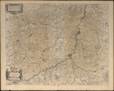
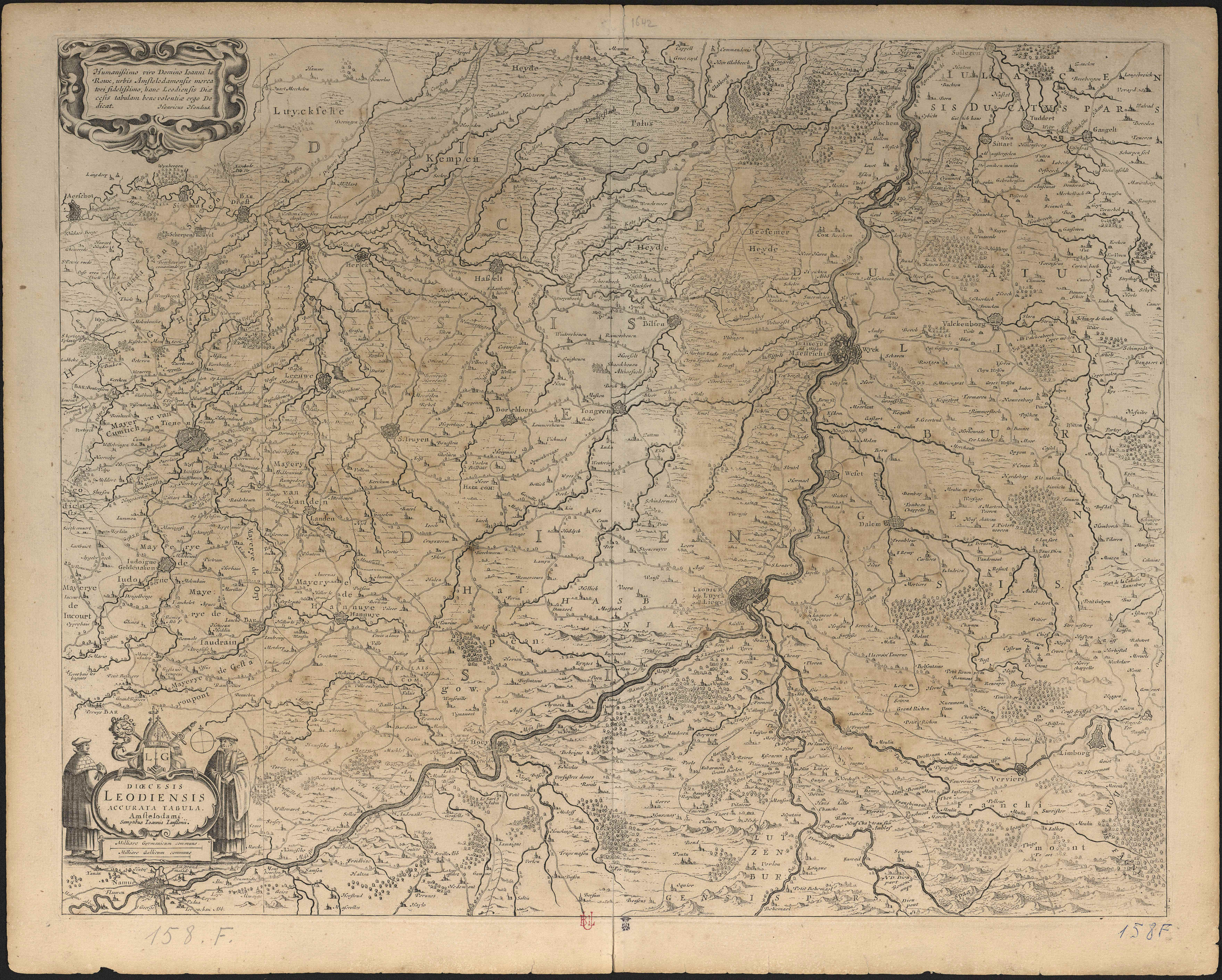
Dioecesis Leodiensis accurata tabula.
Authors, creators, collaborators : Hondius, Hendrik
Type of the represented object : Map
Permalink
https://hdl.handle.net/2268.1/3707
Détails
| Authors, creators, collaborators: | Hondius, Hendrik (1573-1650?) (authors) |
| Producers, publishers: | [Amsterdam] : Amstelodami. Sumptibus Joannis Janssonii |
| Place of creation of the original object: | Amsterdam (Pays-Bas) |
| Creation of the original object: | 17th century Modern times (1492-1789) |
| Original object location: | Réseau des Bibliothèques |
| Collection: | Maps |
| Identifiers: | 158F (cote ULiège) 709504080 (code-barres ULiège) |
| Réseau des Bibliothèques: | Identifier: 990017241270502321 Barcode/Inventory no.: 709504080 Call number: R168A1F |
| Original object language: | Latin |
| Material, support of the original object: | Papier |
| Dimensions, weight or duration: | 46 x 55 cm |
| Physical description of the represented object: | 1 carte. |
| Description: | Notes d'exemplaire : Carte placée dans une pochette en plastique 101 x 72 cm
Date de création : [entre 1613 et 1685] Echelle [1:160 000] |
| Geographical Location represent or evoke: | Liège (principauté) |
| Keyword: | Cartes anciennes |
| Other contributors: | Janssonius, Johannes (1588-1664) (printers-booksellers) |
| Part of: | Public domain |
| Permalink: | https://hdl.handle.net/2268.1/3707 |
Items in DONum are protected by copyright, with all rights reserved, unless otherwise indicated.
