
Informations
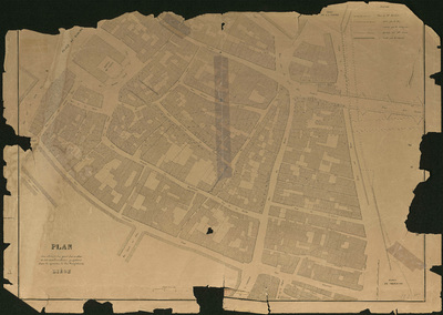
Plan des abords du pont des arches et des améliorations projetées dans le quartier de la Magdelaine. Liège.
Authors, creators, collaborators :
Type of the represented object : Plan (map)
Permalink
https://hdl.handle.net/2268.1/3688
Détails
| Producers, publishers: | S.l. : s.l. |
| First publication of the original object: | 19th century Contemporary time (1789-20..) |
| Original object location: | Réseau des Bibliothèques |
| Collection: | Maps |
| Identifiers: | 122F (cote ULiège) 709504055 (code-barres ULiège) |
| Réseau des Bibliothèques: | Identifier: 990017186060502321 |
| Original object language: | French |
| Material, support of the original object: | Papier |
| Dimensions, weight or duration: | 56 x 72 cm |
| Physical description of the represented object: | 1 carte |
| Description: | Plan urbanistique |
| Geographical Location represent or evoke: | Liège (Belgique) |
| Part of: | Public domain |
| Permalink: | https://hdl.handle.net/2268.1/3688 |

Items in DONum are protected by copyright, with all rights reserved, unless otherwise indicated.
