
Informations
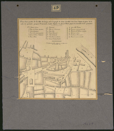
Plan d'une partie de la ville de Liège avec le projet de deux nouvelles rues, l'une depuis la place de la salle de spectacle jusqu'à l'Université, l'autre depuis la place St Paul jusqu'à la rencontre de la première.
Authors, creators, collaborators :
Type of the represented object : Plan (map)
Permalink
https://hdl.handle.net/2268.1/3679
Détails
| Creation of the original object: | c.1824 19th century Contemporary time (1789-20..) |
| Original object location: | Réseau des Bibliothèques |
| Collection: | Maps |
| Identifiers: | 102F (cote ULiège) 709504104 (code-barres ULiège) |
| Réseau des Bibliothèques: | Identifier: 990017188280502321 |
| Original object language: | French |
| Abstract: | Echelle [1:3 940] |
| Material, support of the original object: | Papier |
| Dimensions, weight or duration: | 28 x 25 cm |
| Physical description of the represented object: | 1 carte encartonnée. |
| Keyword: | Cartes anciennes; Liège (Belgique); Liège et sa principauté |
| Part of: | Public domain |
| Permalink: | https://hdl.handle.net/2268.1/3679 |

Items in DONum are protected by copyright, with all rights reserved, unless otherwise indicated.
