
Informations
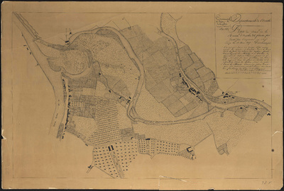
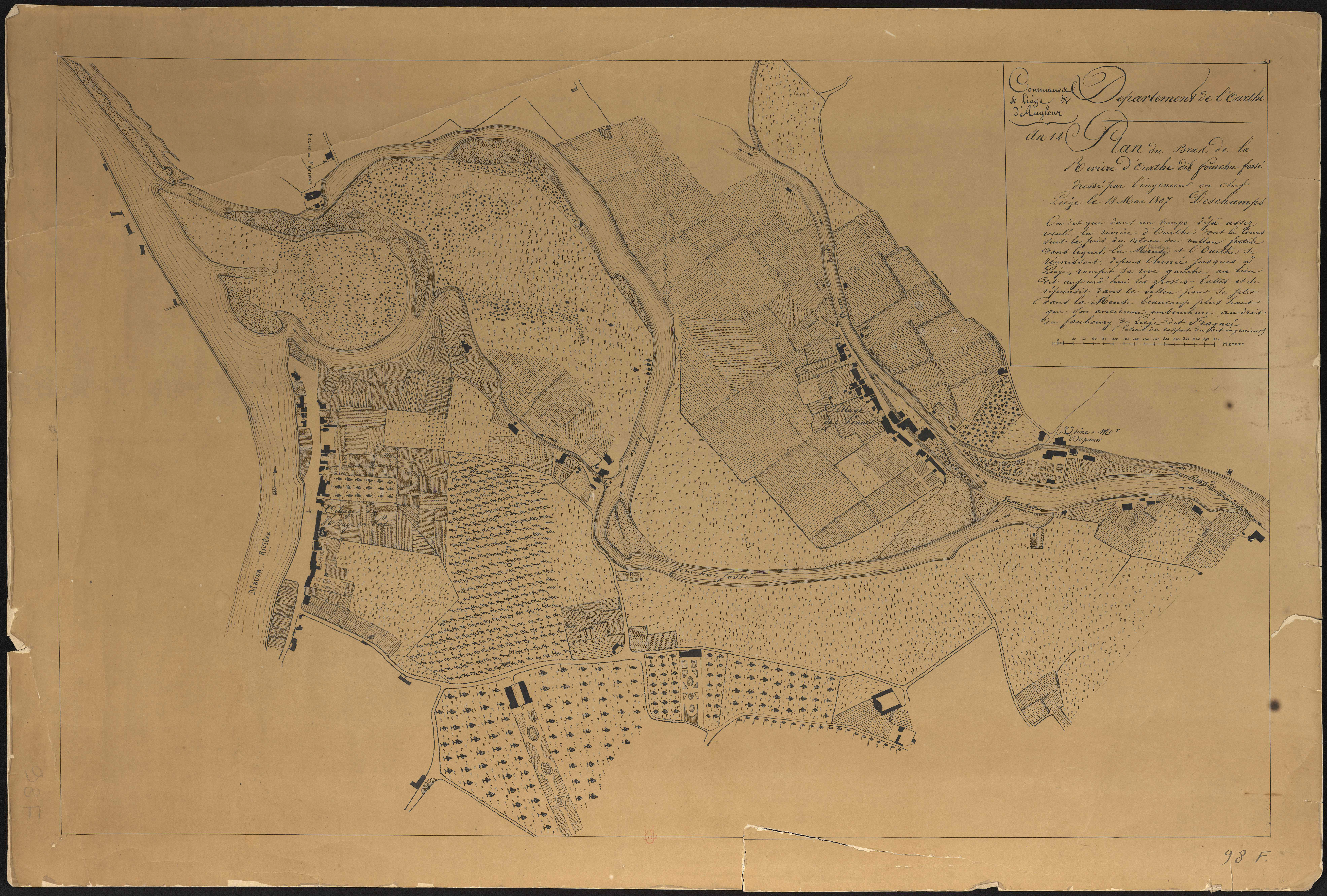
Commune de Liège & d'Angleur. Département de l'Ourthe : plan du bras de la rivière d'Ourthe dit fourchu fossé.
Authors, creators, collaborators : Deschamps
Type of the represented object : Map
Permalink
https://hdl.handle.net/2268.1/3673
Détails
| Authors, creators, collaborators: | Deschamps (authors) |
| Producers, publishers: | [S.l. : s.n.] |
| First publication of the original object: | 1807 19th century Contemporary time (1789-20..) |
| Original object location: | Réseau des Bibliothèques |
| Collection: | Maps |
| Identifiers: | 98F (cote ULiège) 709504051 (code-barres ULiège) |
| Réseau des Bibliothèques: | Identifier: 990017187960502321 |
| Original object language: | French |
| Abstract: | Echelle [1:3 703] |
| Material, support of the original object: | Papier |
| Dimensions, weight or duration: | 42 x 61 cm |
| Physical description of the represented object: | 1 carte |
| Geographical Location represent or evoke: | Liège (Belgique) |
| Keyword: | Ourthe (Belgique cours d'eau) -- Cartes |
| Part of: | Public domain |
| Permalink: | https://hdl.handle.net/2268.1/3673 |
Items in DONum are protected by copyright, with all rights reserved, unless otherwise indicated.
