
Informations
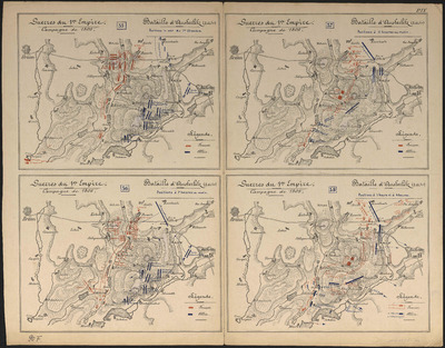
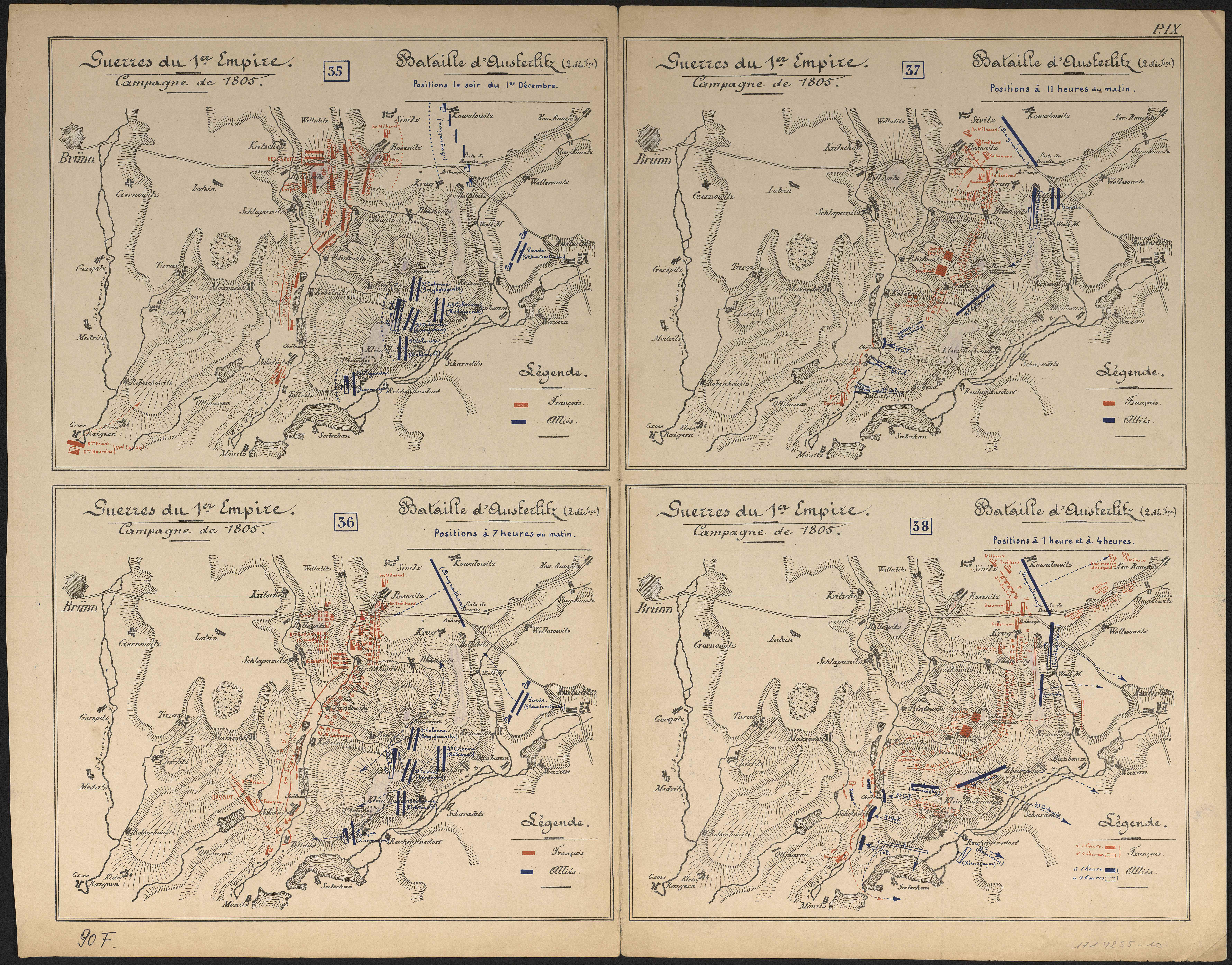
Guerres du 1er Empire : campagne de 1805 : bataille d'Austerlitz (2 décembre).
Author(s), creator(s), collaborator(s) : Jeanne, V.
Type of the represented object : Map
Permalink
https://hdl.handle.net/2268.1/2711
Détails
| Author(s), creator(s), collaborator(s): | Jeanne, V. (author) |
| Editor: | [Bruxelles : Imprimerie et lithographie Ad. Mertens] |
| Place of creation of the original object: | Bruxelles (Belgique) |
| First publication of the original object: | 19th century Contemporary time (1789-20..) |
| Original object location: | Réseau des Bibliothèques |
| Collection: | Maps |
| Identifiant(s): | 90F(9) (cote ULiège) ; 1719255-10 (code-barres ULiège) |
| Original object language: | French |
| Material, support of the original object: | Papier |
| Dimensions, weight or duration: | 50 x 60 cm |
| Physical description of the represented object : | 4 cartes sur 1 feuille : couleurs. |
| Description: | Les cartes concernent les positions le soir du 1er décembre, à 7 heures du matin, à 11 heures du matin, à 1 heure et à 4 heures. Légende reprenant les couleurs utilisées pour représenter les positions des Français et des Alliés. Carte 9 de l'Atlas d'histoire militaire / V. Jeanne. |
| Keyword: | Guerre de la troisième coalition (1805) -- Cartes; Guerres napoléoniennes (1800-1815) -- Campagnes et batailles -- Cartes; Austerlitz; Bataille d' (1805) |
| CREF classification(s): | Histoire |
| Classification(s): | Arts & humanities => History |
| Part of: | Public domain |
| Permalink: | https://hdl.handle.net/2268.1/2711 |
Items in DONum are protected by copyright, with all rights reserved, unless otherwise indicated.