
Informations
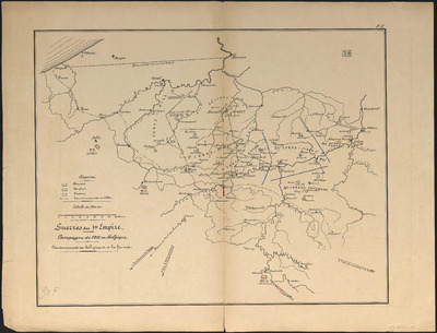
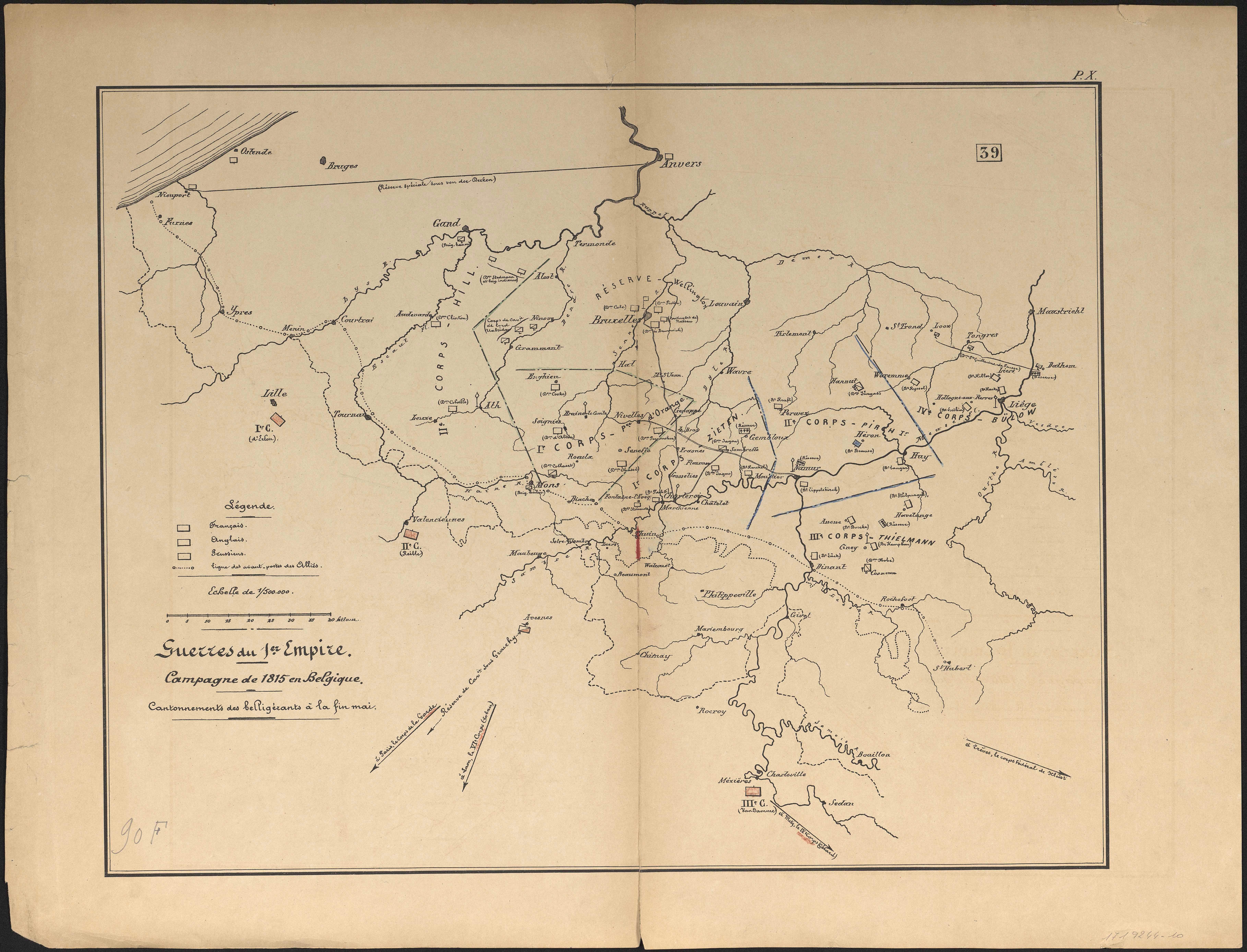
Guerres du 1er Empire : campagne de 1815 en Belgique : cantonnements des belligérants à la fin mai.
Authors, creators, collaborators : Jeanne, V.
Type of the represented object : Map
Permalink
https://hdl.handle.net/2268.1/2710
Détails
| Authors, creators, collaborators: | Jeanne, V. (authors) |
| Producers, publishers: | [Bruxelles : Imprimerie et lithographie Ad. Mertens] |
| Place of creation of the original object: | Bruxelles (Belgique) |
| First publication of the original object: | 19th century Contemporary time (1789-20..) |
| Original object location: | Réseau des Bibliothèques |
| Collection: | Maps |
| Réseau des Bibliothèques: | Identifier: 990017192440502321 Barcode/Inventory no.: 1719244-10 |
| Original object language: | French |
| Material, support of the original object: | Papier |
| Dimensions, weight or duration: | 42 x 50 cm |
| Physical description of the represented object: | 1 carte: couleurs |
| Description: | Légende reprenant les couleurs et le symbole utilisés pour représenter les positions des Français, des Anglais et des Prussiens ainsi que la ligne des avant-postes des Alliés.
Carte 10 de l'Atlas d'histoire militaire / V. Jeanne. |
| Keyword: | Guerre de la troisième coalition (1805) -- Cartes; Guerres napoléoniennes (1800-1815) -- Campagnes et batailles -- Cartes |
| Part of: | Public domain |
| Permalink: | https://hdl.handle.net/2268.1/2710 |
Items in DONum are protected by copyright, with all rights reserved, unless otherwise indicated.
