
Informations
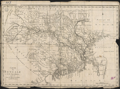
Carte du Bengale et de ses dépendances, dressée d'après des plans pris sur les lieux par W. Bolts.
Authors, creators, collaborators : Bolts, William
Type of the represented object : Map
Permalink
https://hdl.handle.net/2268.1/2694
Détails
| Authors, creators, collaborators: | Bolts, William (1735?-1808) (authors) |
| First publication of the original object: | 1775 18th century Modern times (1492-1789) |
| Original object location: | Réseau des Bibliothèques |
| Collection: | Maps |
| Réseau des Bibliothèques: | Identifier: 990016862920502321 Barcode/Inventory no.: 701100716 Call number: R214A1F |
| Original object language: | French |
| Material, support of the original object: | Papier |
| Dimensions, weight or duration: | 38 x 54 cm |
| Physical description of the represented object: | 1 carte |
| Geographical Location represent or evoke: | Bengale, Province du (Inde, Royaume uni ; 1764-1947) |
| Keyword: | Bengale, Province du (Inde, Royaume uni ; 1764-1947) -- Cartes |
| Part of: | Public domain |
| Permalink: | https://hdl.handle.net/2268.1/2694 |

Items in DONum are protected by copyright, with all rights reserved, unless otherwise indicated.
