
Informations
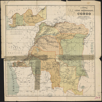
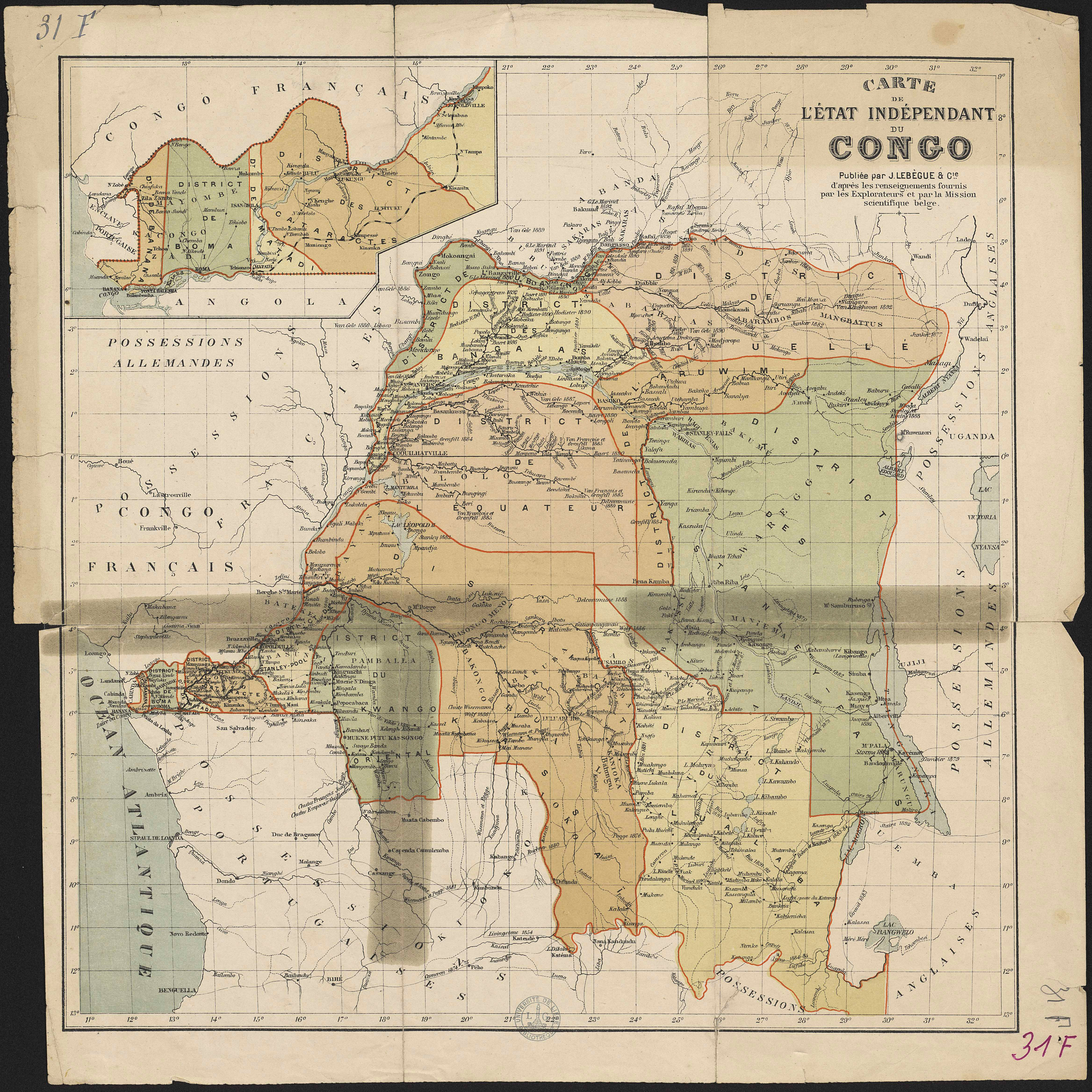
Carte de l'État indépendant du Congo.
Author(s), creator(s), collaborator(s) : Mission scientifique belge
Type of the represented object : Map
Permalink
https://hdl.handle.net/2268.1/2654
Détails
| Author(s), creator(s), collaborator(s): | Mission scientifique belge (author) |
| Editor: | Librairie J. Lebègue & Cie |
| Place of creation of the original object: | Bruxelles (Belgique) |
| First publication of the original object: | 1894 20th century Contemporary time (1789-20..) |
| Original object location: | Réseau des Bibliothèques |
| Collection: | Maps |
| Identifiant(s): | 31F (cote ULiège) ; 701104195 (code-barres ULiège) |
| Original object language: | French |
| Abstract: | Échelle non mentionnée. |
| Material, support of the original object: | Papier |
| Dimensions, weight or duration: | 36 x 35 cm |
| Physical description of the represented object : | 1 carte : couleurs. |
| Geographical Location represent or evoke: | Congo, État indépendant du (Belgique ; 1885-1908) |
| Keyword: | Congo; État indépendant du -- Divisions politiques et administratives; Congo (cours d'eau) -- Bassin |
| CREF classification(s): | Sciences de la terre et du cosmos |
| Classification(s): | Physical, chemical, mathematical & earth Sciences => Earth sciences & physical geography |
| Part of: | Public domain |
| Permalink: | https://hdl.handle.net/2268.1/2654 |
Items in DONum are protected by copyright, with all rights reserved, unless otherwise indicated.