

Informations
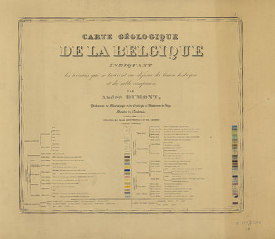
Carte géologique de la Belgique indiquant les terrains qui se trouvent au dessous du limon hesbayen et du sable campinien
Authors, creators, collaborators : Dumont, André Hubert
Type of the represented object : Map
Permalink
https://hdl.handle.net/2268.1/2324
Détails
| Authors, creators, collaborators: | Dumont, André Hubert (1809-1857) (authors) |
| Producers, publishers: | Établissement géographique |
| Place of creation of the original object: | Bruxelles |
| First publication of the original object: | 1856 19th century Contemporary time (1789-20..) |
| Original object location: | Réseau des Bibliothèques |
| Collection: | Maps |
| Réseau des Bibliothèques: | Identifier: 9920013467702321 |
| Original object language: | French |
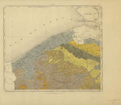
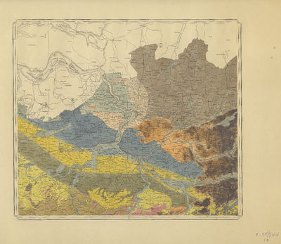
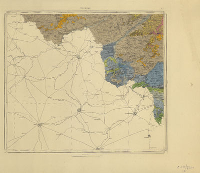
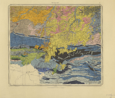
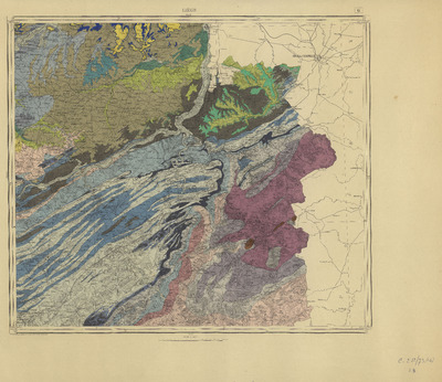
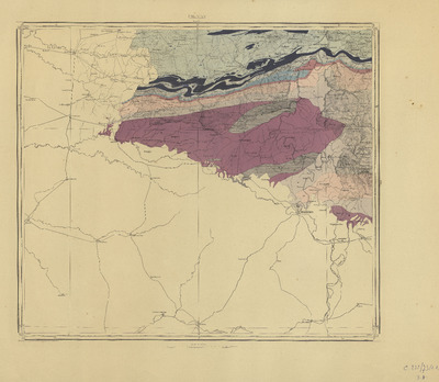
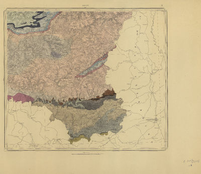
| Abstract: | 1. Gand -- 2. Anvers -- 3. Hasselt -- 4. Tournay -- 5. Bruxelles -- 6. Liége -- 7. Légende -- 8. Chimay -- 9. Arlon |
| Material, support of the original object: | Papier |
| Physical description of the represented object: | 1 carte sur 8 feuilles : couleurs ; 142 x 163 cm sur feuille de 70 x 89 cm + 1 feuille de légende |
| Description: | Échelle 1/160.000 |
| Geographical Location represent or evoke: | Belgique |
| Part of: | Public domain |
| Permalink: | https://hdl.handle.net/2268.1/2324 |


Items in DONum are protected by copyright, with all rights reserved, unless otherwise indicated.
