

Informations
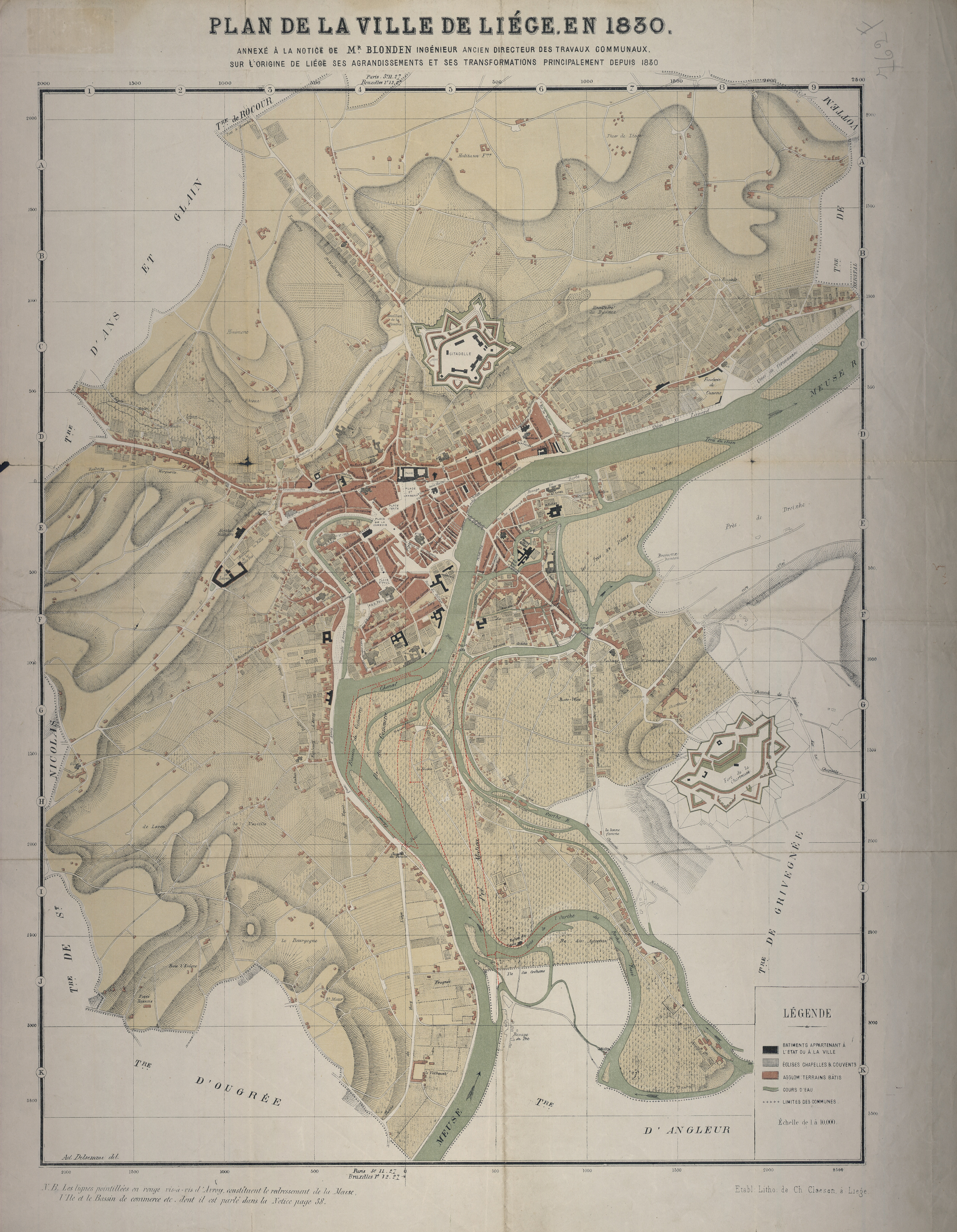
Plan de la ville de Liège en 1830 : annexe à la notice de Mr. Blonden ingénieur, ancien directeur des travaux communaux, sur l'origine de Liège, ses agrandissements et ses transformations principalement depuis 1880
Authors, creators, collaborators :
Type of the represented object : Plan (map)
Permalink
https://hdl.handle.net/2268.1/1504
Détails
| Producers, publishers: | Etablissement lithographique de Ch. Claesen |
| Place of creation of the original object: | Liège (Belgique) |
| Creation of the original object: | 1880 19th century Contemporary time (1789-20..) |
| Original object location: | Réseau des Bibliothèques |
| Collection: | Maps |
| Identifiers: | 000762F (cote ULiège) 709504431 (code-barres ULiège) |
| Réseau des Bibliothèques: | Identifier: 990000075380502321 |
| Original object language: | French |
| Dimensions, weight or duration: | 64 x 53 cm |
| Physical description of the represented object : | 1 plan: noir & blanc |
| Description: | Délimitation en couleurs des 7 commissariats de police. Echelle [1: 10 000] |
| Geographical Location represent or evoke: | Liège (Belgique) |
| Keyword: | Liège (Belgique) -- Plans |
| CREF classifications: | Sciences de la terre et du cosmos Bâtiments, génie civil, transports |
| Classifications: | Physical, chemical, mathematical & earth Sciences => Earth sciences & physical geography |
| Original object linked resource: | "L'origine de Liège : ses agrandissements et ses transformations principalement depuis 1830", Liège : Léon De Thier, 1881 |
| Part of: | Public domain |
| Permalink: | https://hdl.handle.net/2268.1/1504 |
Items in DONum are protected by copyright, with all rights reserved, unless otherwise indicated.
