
Informations
Arrondissement de Liège : canton de Liège.
Authors, creators, collaborators :
Type of the represented object : Plan (map)
Permalink
https://hdl.handle.net/2268.1/1503
Détails
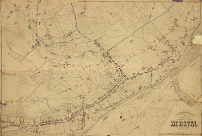
| Producers, publishers: | P.-C. Popp |
| Place of creation of the original object: | Liège (Belgique) |
| Creation of the original object: | 1874/1876 19th century Contemporary time (1789-20..) |
| Original object location: | Réseau des Bibliothèques |
| Collection: | Maps |
| Identifiers: | 000748F (cote ULiège) 709504416 (code-barres ULiège) |
| Réseau des Bibliothèques: | Identifier: 990000090060502321 |
| Original object language: | French |
| Dimensions, weight or duration: | 82 x 117 cm |
| Physical description of the represented object : | 1 plan : noir & blanc, entoilé |
| Description: | Date : [1874-1876], écrite au crayon sur le plan. - Limites des communes en couleurs. - Les différents établissements représentés sont numérotés. Echelle [1: 2 500] |
| Geographical Location represent or evoke: | Liège (Belgique) Herstal (Belgique) |
| Keyword: | Liège (Belgique) -- Plans |
| CREF classifications: | Sciences de la terre et du cosmos Bâtiments, génie civil, transports |
| Classifications: | Physical, chemical, mathematical & earth Sciences => Earth sciences & physical geography |
| Part of: | Public domain |
| Permalink: | https://hdl.handle.net/2268.1/1503 |

Items in DONum are protected by copyright, with all rights reserved, unless otherwise indicated.
