
Informations
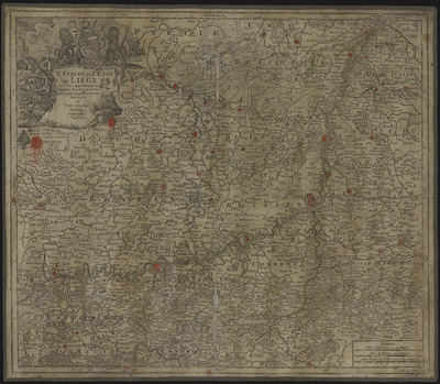
L'évêché et l'Etat de Liège avec les appartenances désignées dans les pais voisins. Délinéation nouvelle et exacte.
Authors, creators, collaborators :
Type of the represented object : Map
Permalink
https://hdl.handle.net/2268.1/14368
Détails
| Producers, publishers: | [Augsbourg] : Au dépens de Tobie Conrad Lotter, géographe |
| Place of creation of the original object: | Augsbourg (Allemagne) |
| First publication of the original object: | [entre 1740 et 1775?] 18th century Modern times (1492-1789) |
| Original object location: | Réseau des Bibliothèques |
| Réseau des Bibliothèques: | Identifier: 990000068000502321 Barcode/Inventory no.: 709504094 Call number: R208A1F |
| Original object language: | French |
| Material, support of the original object: | Papier |
| Physical description of the represented object: | Echelle [environ 1:240 000]. 4 milles de France à 20 au degré 1 carte : couleur, entoilée ; 50 x 58 cm |
| Description: | Echelle donné en trois anciennes mesures : milles d'Allemagne en degré, milles de France en degré, milles d'Italie et d'Angleterre en degré
Titre dans un cartouche orné |
| Keyword: | Liège (Principauté); Cartes anciennes.; Liège (Ecclesiastical principality); Early maps. |
| Other contributors: | Lotter, Tobias Conrad [imprimeur] (1717-1777) (printers-booksellers) |
| Part of: | Public domain |
| Permalink: | https://hdl.handle.net/2268.1/14368 |

Items in DONum are protected by copyright, with all rights reserved, unless otherwise indicated.
