
Informations
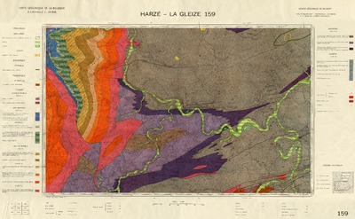
Carte géologique de la Belgique à l'échelle 1:25.000. no.159, Harzé - La Gleize
Authors, creators, collaborators : Asselberghs, Etienne; Geukens, Ferdinand
Type of the represented object : Map
Permalink
https://hdl.handle.net/2268.1/1173
Détails
| Authors, creators, collaborators: | Asselberghs, Etienne (1889-1959) (authors) Geukens, Ferdinand (1919-2019) (authors) |
| Producers, publishers: | Institut géographique militaire |
| Place of creation of the original object: | Bruxelles |
| Creation of the original object: | 1960 20th century Contemporary time (1789-20..) |
| Original object location: | Réseau des Bibliothèques |
| Réseau des Bibliothèques: | Identifier: 990002040820502321 |
| Original object language: | French |
| Material, support of the original object: | papier |
| Dimensions, weight or duration: | 40 x 64 cm, sur feuille de 60 x 93 cm |
| Physical description of the represented object: | 1 carte : coul. |
| Description: | Echelle 1:25.000 |
| Geographical Location represent or evoke: | Belgique |
| Original object is part of: | Cartes géologiques de la Belgique au 1:25.000 |
| Part of: | Protected domain |
| Permalink: | https://hdl.handle.net/2268.1/1173 |


Harze-LaGleize.pdf
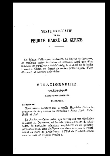
Description: Livret explicatif
Size: 3.65 MB
Format: Adobe PDF
Access type: Open Access
Description: Livret explicatif
Size: 3.65 MB
Format: Adobe PDF
Access type: Open Access
Items in DONum are protected by copyright, with all rights reserved, unless otherwise indicated.
