


Informations
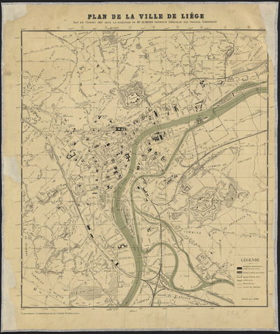
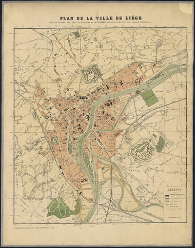
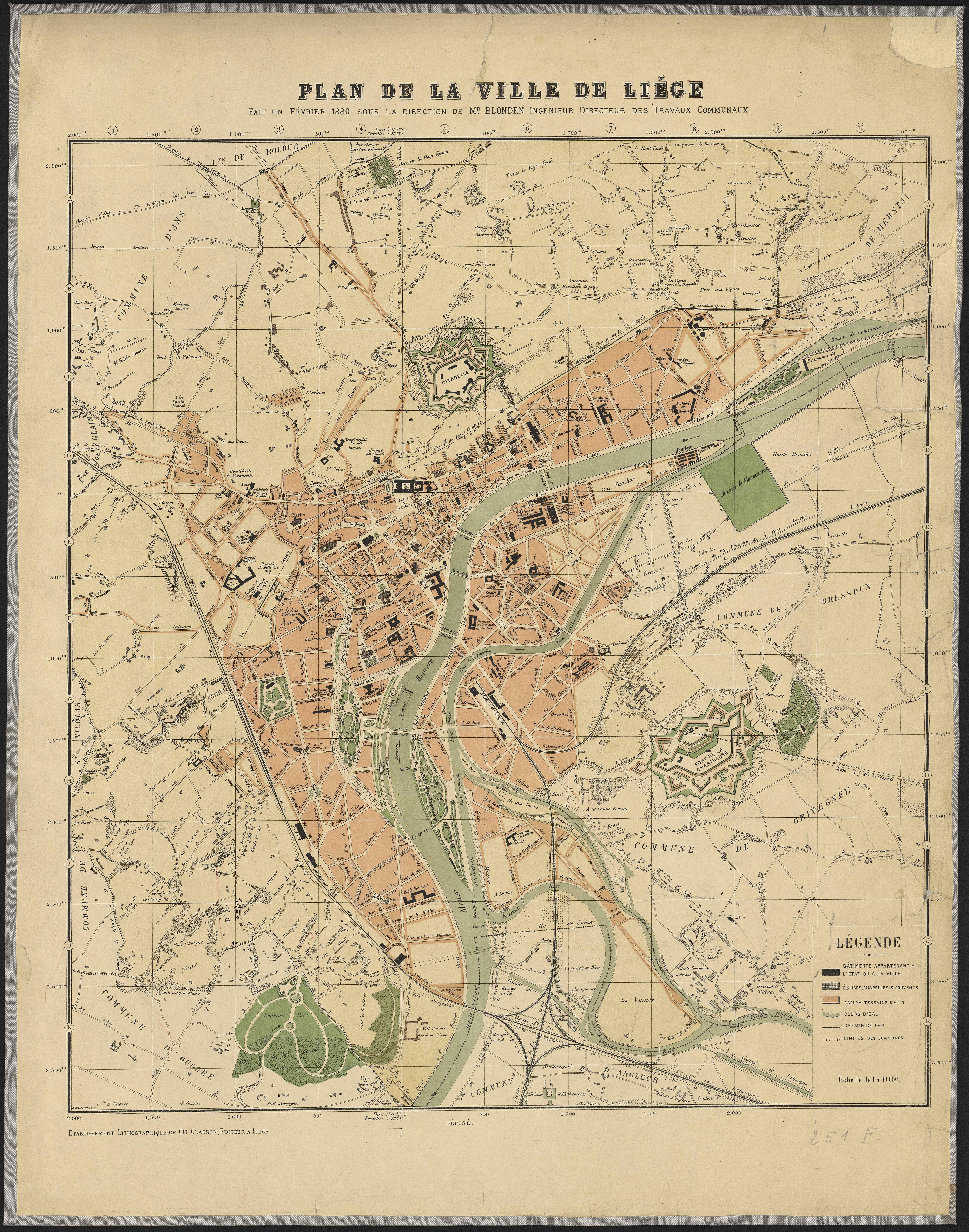
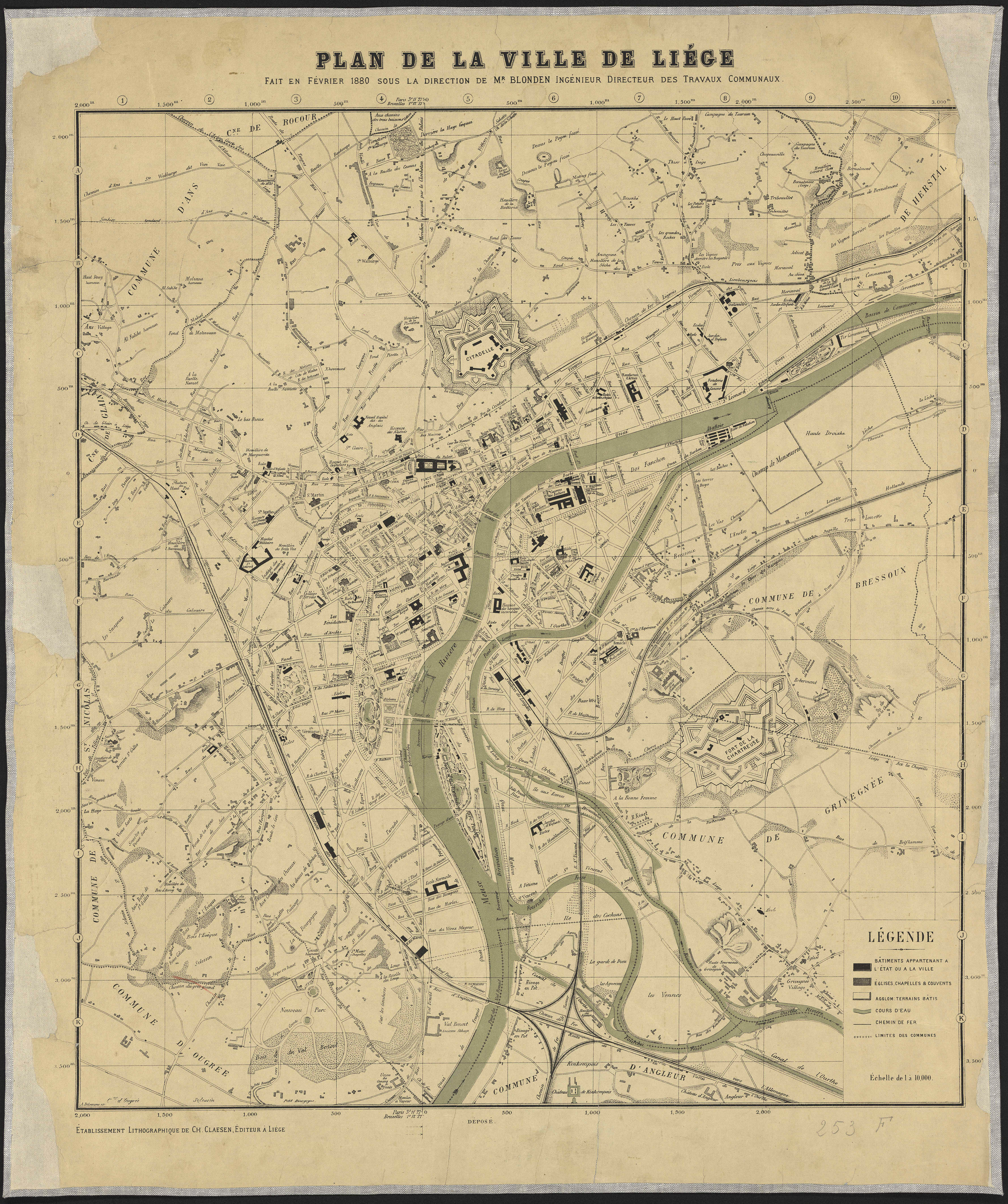
Plan de la ville de Liège fait en février 1880
Authors, creators, collaborators : Blonden, Hubert-Guillaume
Type of the represented object : Plan (map)
Permalink
https://hdl.handle.net/2268.1/1146
Détails
| Authors, creators, collaborators: | Blonden, Hubert-Guillaume (1816-1881) (editors) |
| Producers, publishers: | Établissement lithographique de Ch. Claesen |
| Place of creation of the original object: | Liège (Belgique) |
| Creation of the original object: | 1880 19th century Contemporary time (1789-20..) |
| Original object location: | Réseau des Bibliothèques |
| Collection: | Maps |
| Réseau des Bibliothèques: | Identifier: 990017970450502321 Barcode/Inventory no.: 709504320 ; 709504317 Call number: 251F ; 253F |
| Original object language: | French |
| Material, support of the original object: | Papier |
| Dimensions, weight or duration: | 61 x 53 cm. |
| Physical description of the represented object: | 1 carte : couleur ; 61 x 53 cm |
| Description: | Légende reprenant les symboles utilisés pour représenter les bâtiments appartenant à l'Etat ou à la ville, les édifices religieux, les agglomérations, les cours d'eau, les chemins de fer, les limites communales Echelle 1:10 000 (E 5°34'06"--E 5°34'06"/N 50°38'45"--N 50°38'45") |
| Keyword: | Liège (Belgique) -- Plans; Liege (Belgium) -- Maps; Liège (Belgique) |
| Part of: | Public domain |
| Permalink: | https://hdl.handle.net/2268.1/1146 |
Items in DONum are protected by copyright, with all rights reserved, unless otherwise indicated.
