
Informations
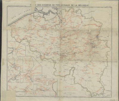
Carte des chemins de fer vicinaux de la Belgique
Authors, creators, collaborators : Société nationale des chemins de fer vicinaux
Type of the represented object : Map
Permalink
https://hdl.handle.net/2268.1/10562
Détails
| Authors, creators, collaborators: | Société nationale des chemins de fer vicinaux (Belgique) (authors) |
| Producers, publishers: | [Bruxelles] : Institut cartographique militaire |
| Place of creation of the original object: | Bruxelles (Belgique) |
| First publication of the original object: | 1902 20th century Contemporary time (1789-20..) |
| Original object location: | Réseau des Bibliothèques |
| Réseau des Bibliothèques: | Identifier: 990018051940502321 Barcode/Inventory no.: 1805194-10 Call number: 000298F |
| Original object language: | French |
| Abstract: | Légendes reprenant les signes utilisés pour représenter les différentes lignes de chemins de fer
Encart : Anvers. Echelle 1:150 000 ; Gand. Echelle 1:150 000 ; Liège. Echelle 1:150 000 ; Bruxelles. Echelle 1:150 000 ; Mons. Echelle [1:150 000] ; La Louvière. Echelle 1:150 000 ; Charleroi. Echelle 1:150 000 ; Namur. Echelle 1:100 000 |
| Material, support of the original object: | Papier |
| Dimensions, weight or duration: | 57 x 67 cm |
| Physical description of the represented object: | 1 carte en couleur |
| Description: | Echelle 1:400 000 |
| Geographical Location represent or evoke: | Belgique |
| Keyword: | Cartes; Chemins de fer -- Belgique -- 20e siècle |
| Part of: | Public domain |
| Permalink: | https://hdl.handle.net/2268.1/10562 |

Items in DONum are protected by copyright, with all rights reserved, unless otherwise indicated.
