

Informations
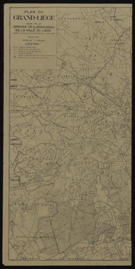
Plan du Grand-Liège
Authors, creators, collaborators : Liège
Type of the represented object : Map
Permalink
https://hdl.handle.net/2268.1/10064
Détails
| Authors, creators, collaborators: | Liège (Belgique ; Province). Service de l'urbanisme (authors) |
| Producers, publishers: | Saint-Ouen : Gaston Maillet et Cie |
| First publication of the original object: | 1943 20th century Contemporary time (1789-20..) |
| Original object location: | Réseau des Bibliothèques |
| Réseau des Bibliothèques: | Identifier: 990017173950502321 Barcode/Inventory no.: 701104181 Call number: 000006F |
| Original object language: | French |
| Material, support of the original object: | Papier |
| Dimensions, weight or duration: | 74 x 72 cm. |
| Physical description of the represented object: | 1 carte Echelle 1:25 000 |
| Description: | Légende reprenant les symboles utilisés pour représenter les limites du Grand-Liège, les autres limites de communes, les anciennes limites de communes, les limites de districts, les parties communes aux deux limites précédentes et les numéros des districts (placés près du chef-lieu)
Notes d'exemplaire : Placée dans une pochette en plastique 101 x 72 cm |
| Geographical Location represent or evoke: | Liège (Belgique) |
| Keyword: | Cartes; Maps |
| Part of: | Public domain |
| Permalink: | https://hdl.handle.net/2268.1/10064 |

Items in DONum are protected by copyright, with all rights reserved, unless otherwise indicated.
